
Transportation modeling
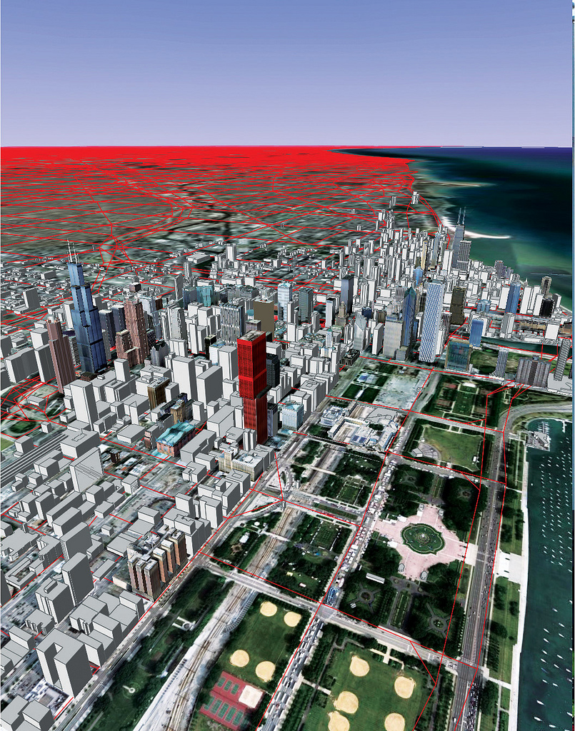
The red lines on this map of Chicago represent the different roads modeled by the TRANSIMS software program at Argonne National Laboratory's Transportation Research and Analysis Computing Center. The model has great resolution in the downtown area, but also incorporates a network of highways and thoroughfares that extends from Milwaukee to Kankakee and from Lake Michigan out to Rockford . Read the full story.