j808armada – Flickr

Bild: j808armada

Aerial of Minato, Japan.

MINATO, Japan (March 18, 2011) An aerial view of Minato, Japan, a week after a 9.0 magnitude earthquake and subsequent tsunami devastated the area. (U.S. Marine Corps photo by Lance Cpl. Ethan Johnson/Released)

dugspr — Home for Good – Flickr

U.S. Pacific Fleet – Flickr

U.S. Pacific Fleet – Flickr

Japan’s Coastline Before and After the Tsunami

These images show the effects of the tsunami on Japan's coastline. The image on the left was taken on Sept. 5, 2010; the image on the right was taken on March 12, 2011, one day after an earthquake and resulting tsunami struck the island nation.
NASA

holding-2

There is a story that if you fold a thousand paper cranes, you get a wish. Looking at the devastation in Japan....I find myself holding my breath, not being able to take it all in. My colleagues and I had been folding cranes for a memorial, and had reached our goal of 1,000+ Perhaps you'll make a donation to an aid organization of your choice and take this photograph as a reminder of your wish for the Japanese people as they recover.

DigitalGlobe-Imagery – Flickr

Earthquake and Tsunami near Sendai, Japan on March 11, 2011

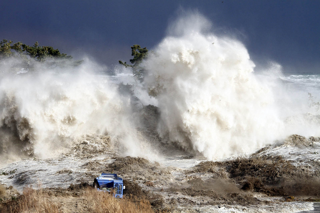
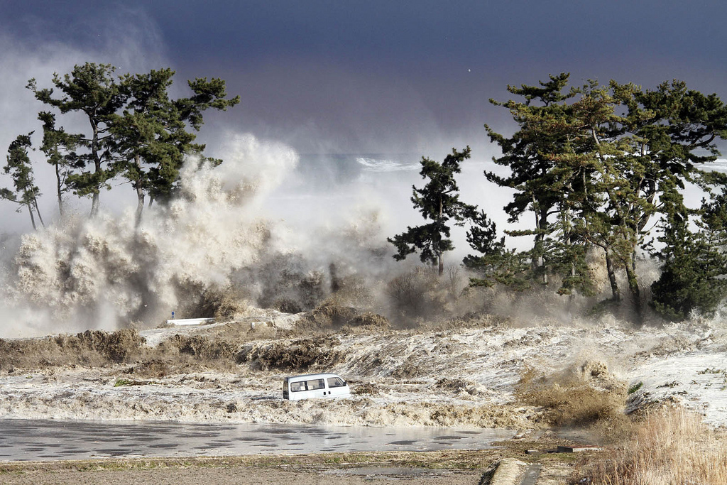
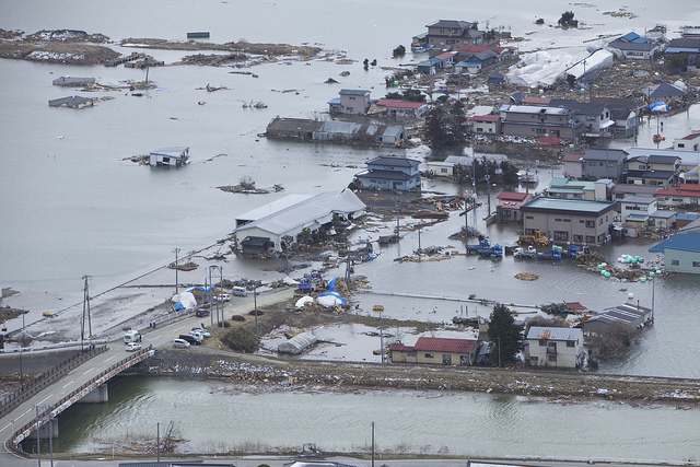
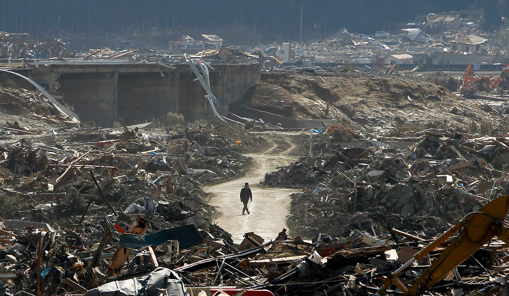
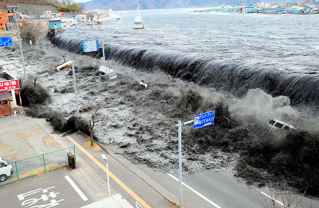
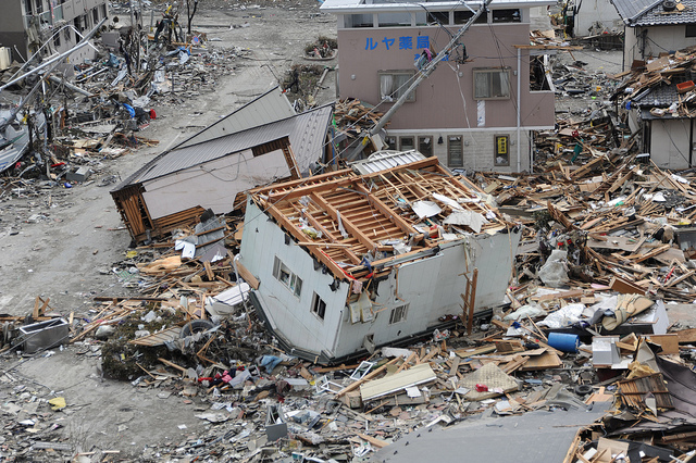
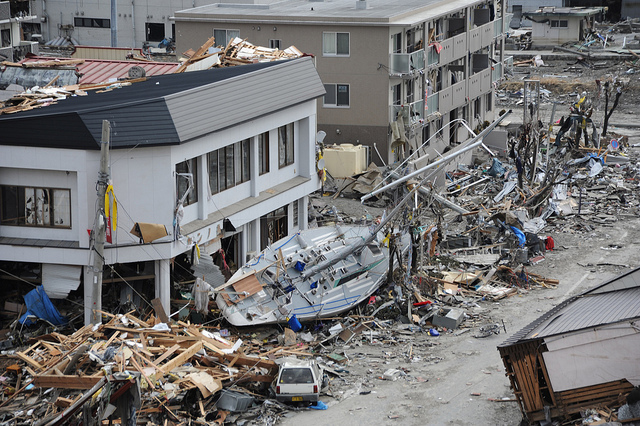
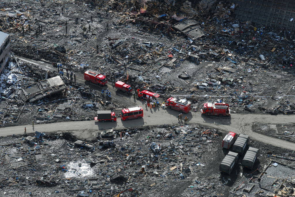
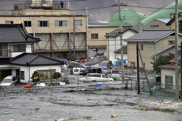
On March 11, 2011, at 2:46 p.m. local time (05:46 Universal Time, or UTC), a magnitude 8.9 earthquake struck off the east coast of Japan, at 38.3 degrees North latitude and 142.4 degrees East longitude. The epicenter was 130 kilometers (80 miles) east of Sendai, and 373 kilometers (231 miles) northeast of Tokyo. If the initial measurements are confirmed, it will be the world's fifth largest earthquake since 1900. 
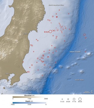
This map shows the location of the March 11 earthquake, as well as the foreshocks (dotted lines) and aftershocks (solid lines). The size of each circle represents the magnitude of the associated quake or shock. The map also includes land elevation data from NASA's Shuttle Radar Topography Mission and ocean bathymetry data from the British Oceanographic Data Center.
Bild: Twitter

A tsunami, tidal wave smashes vehicles and houses at Kesennuma city in Miyagi prefecture

A tsunami, tidal wave smashes vehicles and houses at Kesennuma city in Miyagi prefecture, northern Japan on March 11, 2011. A massive 8.9-magnitude earthquake shook Japan, unleashing a powerful tsunami that sent ships crashing into the shore and carried cars through the streets of coastal towns. AFP PHOTO / YOMIURI SHIMBUN (JAPAN OUT, RESTRICTED TO EDITORIAL USE) (Photo credit should read STR/AFP/Getty Images)