
EUMETSAT Latest Images IR 3.9 Central Europe Color

EUMETSAT Latest Images IR 3.9 Central Europe Color
EUMETSAT Latest Images RGB Composites Dust Central Europe Color

Dust is an RGB composite based upon infrared channel data from the Meteosat Second Generation satellite. It is designed to monitor the evolution of dust storms during both day and night. The Dust RGB is composed from data from a combination of the SEVIRI IR8.7, IR10.8 and IR12.0 channels
EUMETSAT Latest Images RGB Airmass Central Europe Color
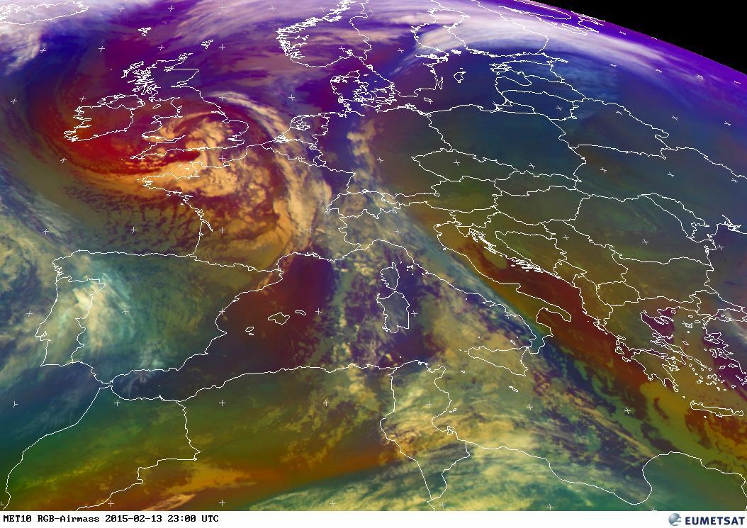
Airmass is an RGB composite based upon data from infrared and water vapour channels from Meteosat Second Generation. It is designed and tuned to monitor the evolution of cyclones, in particular rapid cyclogenesis, jet streaks and PV (potential vorticity) anomalies. Due to the incorporation of the water vapour and ozone channels, its usage at high satellite viewing angles is limited. The Airmass RGB is composed from data from a combination of the SEVIRI WV6.2, WV7.3, IR9.7 and IR10.8 channels
EUMETSAT Latest Images RGB Fog Central Europe Color
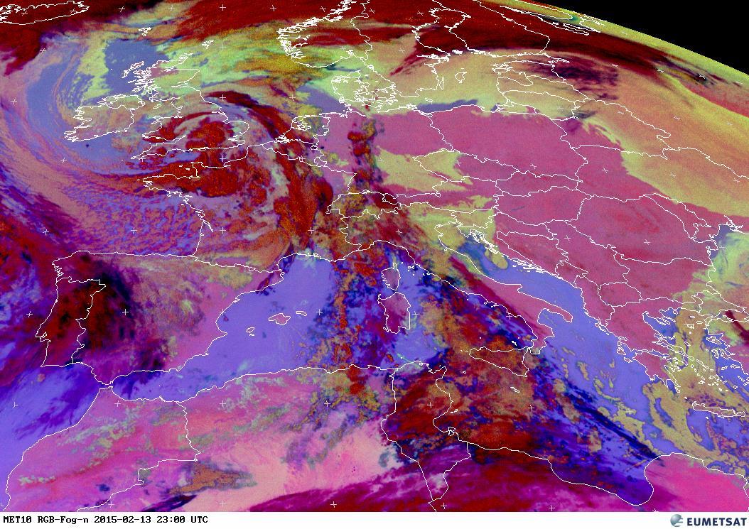
Fog / Low Clouds is an RGB composite based upon infrared channel data from the Meteosat Second Generation satellite. It is designed and tuned to monitor the evolution of night-time fog / low stratus. Other (secondary) applications are the detection of fires, low-level moisture boundaries and cloud classification in general. It should be noted that as the product is tuned for night-time conditions, its use during day-time is very limited. The Fog / Low Clouds RGB is composed from data from a combination of the SEVIRI IR3.9, IR10.8 and IR12.0 channels
EUMETSAT Latest Images RGB Day Microphysics Central Europe Color

The Day Microphysics RGB was inherited from Rosenfeld and Lensky (1998): the VIS0.8 reflectance in red approximates the cloud optical depth and amount of cloud water and ice; the IR3.9 solar reflectance in green is a qualitative measure for cloud particle size and phase, and the IR10.8 brightness temperature modulates the blue. This color scheme is useful for cloud analysis, convection, fog, snow, and fires. In this colour scheme water clouds that do not precipitate appear white because cloud drops are small, whereas large drops that are typical to precipitating clouds appear pink, because of the low reflectance at IR3.9 manifested as low green. Supercooled water clouds appear more yellow, because the lower temperature that modulate the blue component. Cold and thick clouds with tops composed of large ice particles, e.g., Cb tops, appear red. Optically thick clouds with small ice particles near their tops appear orange.
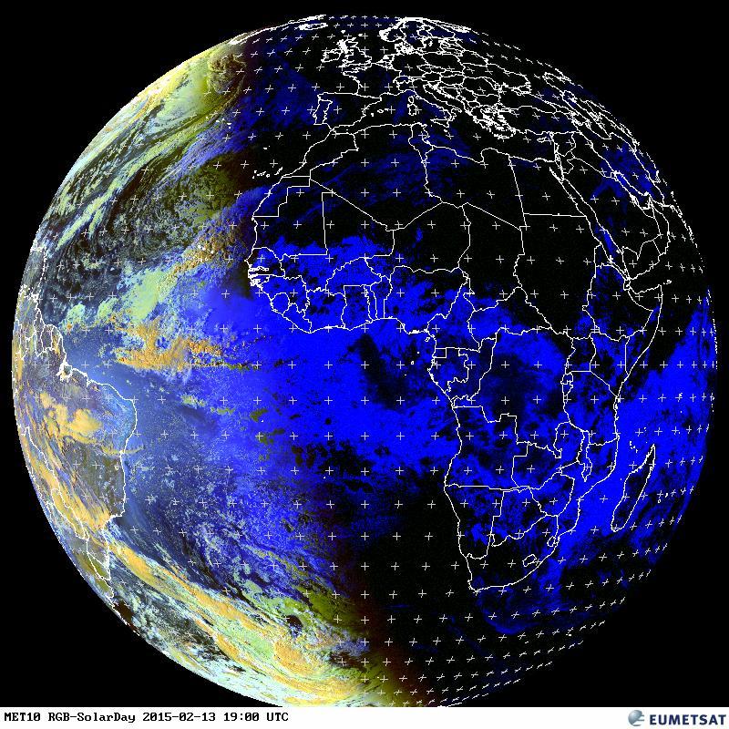
EUMETSAT Latest Images RGB Natural Color Central Europe Color
The Natural Color RGB makes use of three solar channels: VIS0.6, VIS0.8 and NIR1.6. In this color scheme vegetation appears greenish because of its large reflectance in the VIS0.8 channel (the green beam) compared to the NIR1.6 (red beam) and VIS0.6 (blue beam) channels. Water clouds with small droplets have large reflectance at all three channels and hence appear whitish, while snow and ice clouds appears cyan because ice strongly absorbs in NIR1.6 (no red). Bare ground appears brown because of the larger reflectance in the NIR1.6 than at VIS0.6, and the ocean appears black because of the low reflectance in all three channels.
EUMETSAT Latest Images RGB Snow/Solar Day Central Europe
The main application of the Snow RGB is the detection of fog / low clouds and snow during day-time. In this color scheme snow appears red because of the strong absorption in the NIR1.6 and IR3.9 channels (no green and blue), while fog / low clouds appear whitish. Small particle ice cloud appears orange, while large particle ice cloud appears with greater red component. Snow on the ground appears as full red, because its grains are usually much larger than cloud ice particles.
EUMETSAT Latest Images MPE (Multi-Sensor Precipitation Estimate) Central Europe

The Multi-Sensor Precipitation Estimate (MPE) product consists of the near-real-time rain rates in mm/hr for each Meteosat image in original pixel resolution. The algorithm is based on the combination of polar orbiter microwave measurements and images in the Meteosat IR channel by a so-called blending technique. The MPE is most suitable for convective precipitation. Applications and Users: Operational weather forecasting in areas with poor or no radar coverage, especially in Africa and Asia.
EUMETSAT Latest Images Fire Central Europe
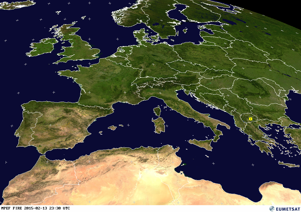
The active fire monitoring product (FIR) is a fire detection product indicating the presence of fire within a pixel. The underlying concept of the algorithm takes advantage of the fact that SEVIRI channel IR3.9 is very sensitive to hot spots which are caused by fires. The algorithm distinguishes between potential fire and active fire. Applications and Users: Fire detection and monitoring.
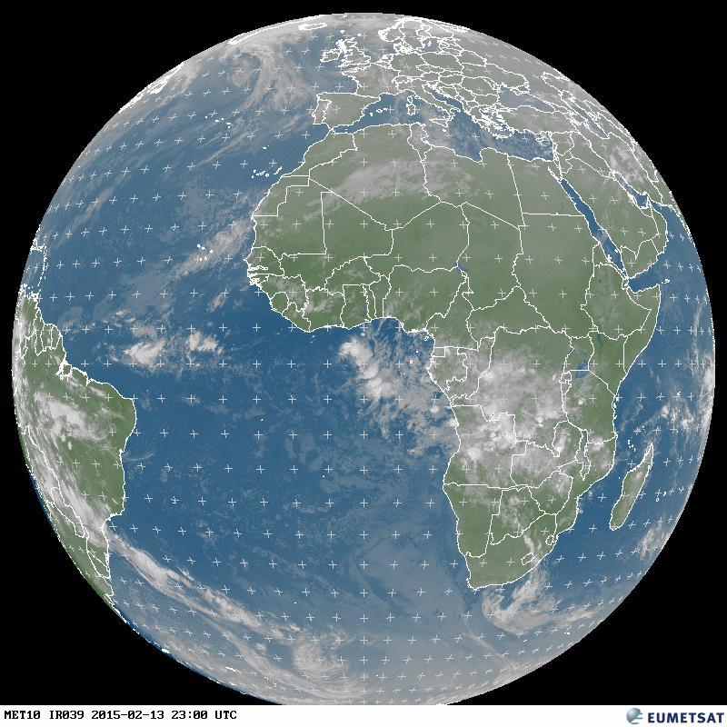
EUMETSAT Latest Images IR (Infrarot) 3.9 Weltkugel
EUMETSAT Latest Images RGB Composites Dust Weltkugel

Dust is an RGB composite based upon infrared channel data from the Meteosat Second Generation satellite. It is designed to monitor the evolution of dust storms during both day and night. The Dust RGB is composed from data from a combination of the SEVIRI IR8.7, IR10.8 and IR12.0 channels
EUMETSAT Latest Images RGB Airmass Weltkugel
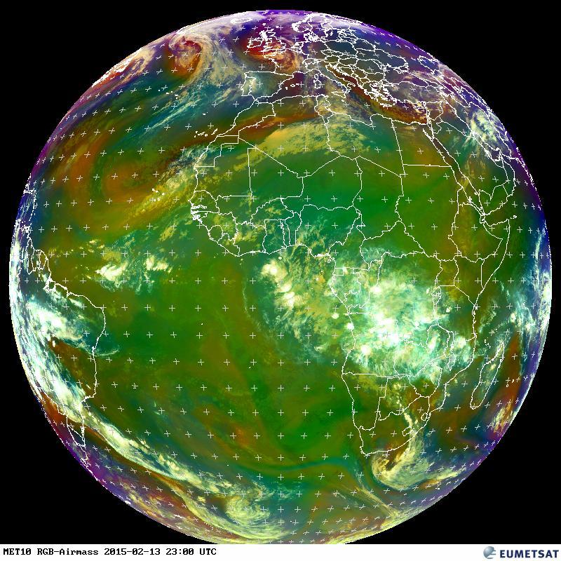
Airmass is an RGB composite based upon data from infrared and water vapour channels from Meteosat Second Generation. It is designed and tuned to monitor the evolution of cyclones, in particular rapid cyclogenesis, jet streaks and PV (potential vorticity) anomalies. Due to the incorporation of the water vapour and ozone channels, its usage at high satellite viewing angles is limited. The Airmass RGB is composed from data from a combination of the SEVIRI WV6.2, WV7.3, IR9.7 and IR10.8 channels
EUMETSAT Latest Images RGB Fog Weltkugel
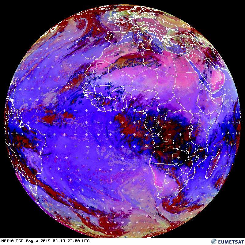
Fog / Low Clouds is an RGB composite based upon infrared channel data from the Meteosat Second Generation satellite. It is designed and tuned to monitor the evolution of night-time fog / low stratus. Other (secondary) applications are the detection of fires, low-level moisture boundaries and cloud classification in general. It should be noted that as the product is tuned for night-time conditions, its use during day-time is very limited. The Fog / Low Clouds RGB is composed from data from a combination of the SEVIRI IR3.9, IR10.8 and IR12.0 channels
EUMETSAT Latest Images RGB Day Microphysics Weltkugel

The Day Microphysics RGB was inherited from Rosenfeld and Lensky (1998): the VIS0.8 reflectance in red approximates the cloud optical depth and amount of cloud water and ice; the IR3.9 solar reflectance in green is a qualitative measure for cloud particle size and phase, and the IR10.8 brightness temperature modulates the blue. This color scheme is useful for cloud analysis, convection, fog, snow, and fires. In this colour scheme water clouds that do not precipitate appear white because cloud drops are small, whereas large drops that are typical to precipitating clouds appear pink, because of the low reflectance at IR3.9 manifested as low green. Supercooled water clouds appear more yellow, because the lower temperature that modulate the blue component. Cold and thick clouds with tops composed of large ice particles, e.g., Cb tops, appear red. Optically thick clouds with small ice particles near their tops appear orange.
EUMETSAT Latest Images RGB Natural Color Weltkugel

The Natural Color RGB makes use of three solar channels: VIS0.6, VIS0.8 and NIR1.6. In this color scheme vegetation appears greenish because of its large reflectance in the VIS0.8 channel (the green beam) compared to the NIR1.6 (red beam) and VIS0.6 (blue beam) channels. Water clouds with small droplets have large reflectance at all three channels and hence appear whitish, while snow and ice clouds appears cyan because ice strongly absorbs in NIR1.6 (no red). Bare ground appears brown because of the larger reflectance in the NIR1.6 than at VIS0.6, and the ocean appears black because of the low reflectance in all three channels.
EUMETSAT Latest Images RGB Snow/Solar Day Weltkugel
The main application of the Snow RGB is the detection of fog / low clouds and snow during day-time. In this color scheme snow appears red because of the strong absorption in the NIR1.6 and IR3.9 channels (no green and blue), while fog / low clouds appear whitish. Small particle ice cloud appears orange, while large particle ice cloud appears with greater red component. Snow on the ground appears as full red, because its grains are usually much larger than cloud ice particles.
EUMETSAT Latest Images MPE (Multi-Sensor Precipitation Estimate) Weltkugel

The Multi-Sensor Precipitation Estimate (MPE) product consists of the near-real-time rain rates in mm/hr for each Meteosat image in original pixel resolution. The algorithm is based on the combination of polar orbiter microwave measurements and images in the Meteosat IR channel by a so-called blending technique. The MPE is most suitable for convective precipitation. Applications and Users: Operational weather forecasting in areas with poor or no radar coverage, especially in Africa and Asia.
EUMETSAT Latest Images Fire Weltkugel
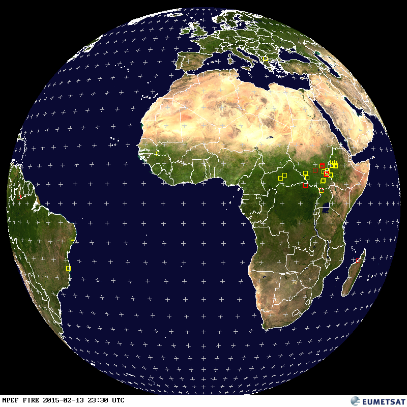
The active fire monitoring product (FIR) is a fire detection product indicating the presence of fire within a pixel. The underlying concept of the algorithm takes advantage of the fact that SEVIRI channel IR3.9 is very sensitive to hot spots which are caused by fires. The algorithm distinguishes between potential fire and active fire. Applications and Users: Fire detection and monitoring.
EUMETSAT Latest Images AMV (Atmospheric Motion Vectors) Weltkugel
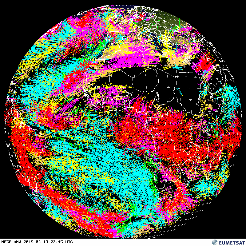
The Atmospheric Motion Vectors (AMV) product consists wind vectors computed at differend heights derived by tracking the motion of the clouds and other atmospheric constituents (e.g. water vapour patterns and ozone). In this example, the wind vectors are derived IR 10.8 images.
EUMETSAT Latest Images GII (Global Instability Index) Weltkugel

The Global Instability Index (GII) represents the atmospheric air mass instability in cloud free areas. The original statistical algorithm was developed by the SAF in support of Nowcasting and Very Short Range Forecasting but the GII is produced at EUMETSAT. The algorithm has later been replaced by a physical retrieval scheme. Applications and Users: Nowcasting (forecasting up to six hours) severe weather.
EUMETSAT Latest Images CLA (Cloud Analysis) Weltkugel
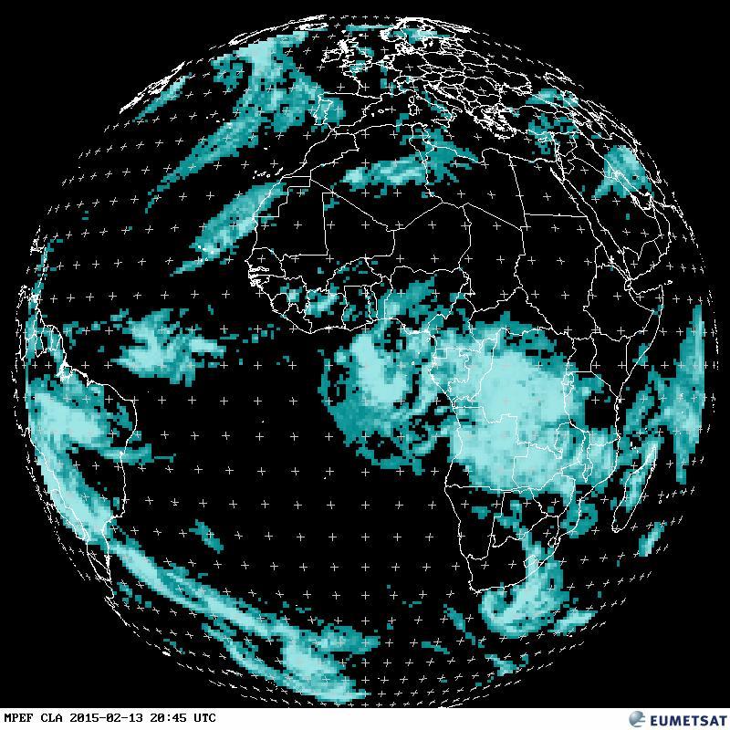
The Cloud Analysis (CLA) Product provides an identification of cloud layers with cloud type and coverage, height and temperature. Applications and Users: Weather forecasting, numerical weather prediction, climate research and monitoring.
EUMETSAT Latest Images CLAI (Cloud Analysis Image) Weltkugel
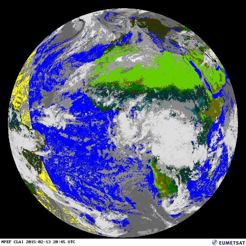
The Cloud Analysis Image (CLAI) provides an identification of scenes type for each image segment. This is an image product derived along with CLA. Applications and Users: Weather forecasting, numerical weather prediction, climate research and monitoring. This is an image product derived along with CLA.
EUMETSAT Latest Images CLM (Cloud Mask) Weltkugel
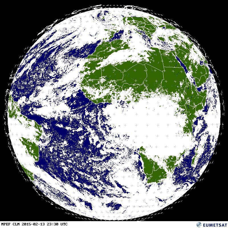
The Cloud Mask (CLM) product describes the scene type (either clear or cloudy) on a pixel level. Each pixel is classified as one of the following four types: clear sky over water, clear sky over land, cloud or not processed (off Earth disc). Applications and Users: The main use is in support of Nowcasting applications, where it frequently serves as a basis for other cloud products, and the remote sensing of continental and ocean surfaces.
EUMETSAT Latest Images CTH (Cloud Top Height) Weltkugel
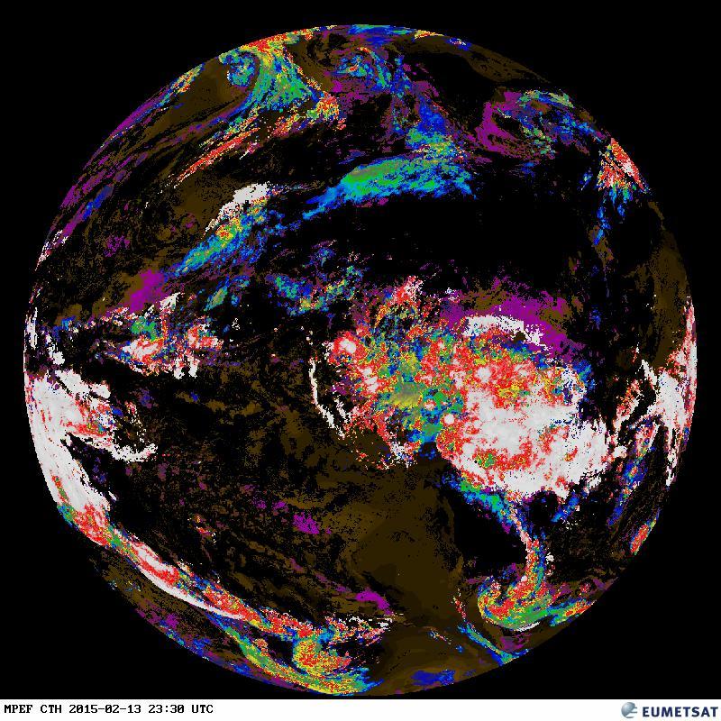
The Cloud Top Height (CTH) product indicates the height of highest cloud. Based on a subset of the information derived during Scenes and Cloud Analysis, but also makes use of other external meteorological data. Applications and Users: Aviation meteorology.
EUMETSAT Latest Images TH (Tropospheric Humidity) Weltkugel
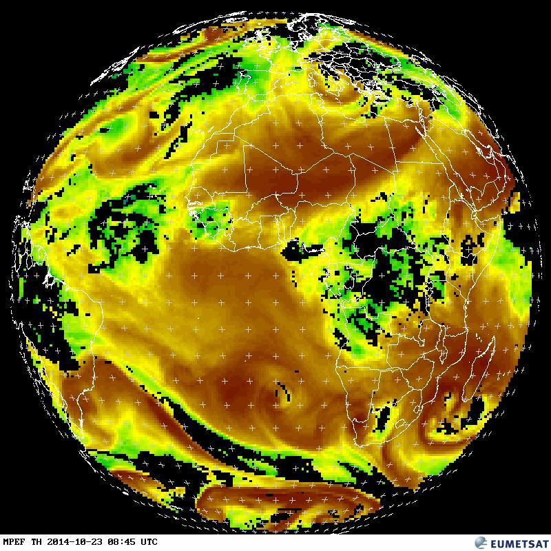
The Tropospheric Humidity Product (TH) provides relative humidity in both mid and upper layers of the troposphere, using a 16 x 16 pixel segment grid. The upper level is derived from the mean layer relative humidity between about 600 hPa and 300 hPa using the WV6.2 micron channel, while mid-tropospheric humidity represents the mean value between 850 hPa and 600 hPa using the WV7.3 micron channel
EUMETSAT Latest Images TOZ (Total Ozone) Weltkugel
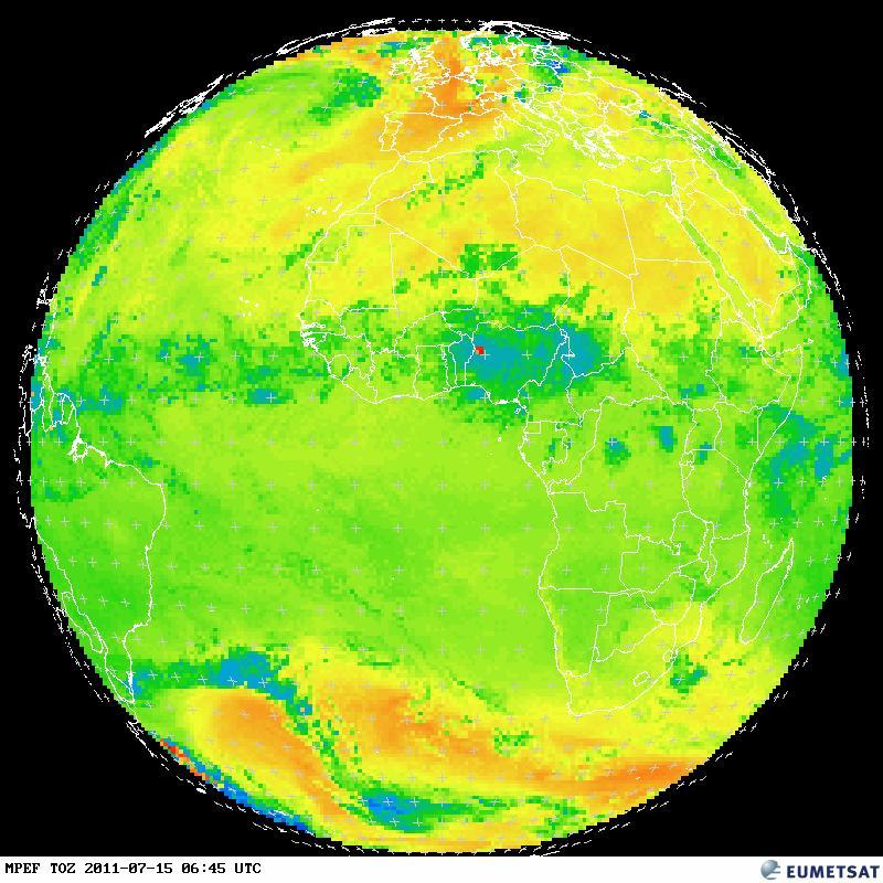
The Total Ozone (TOZ) product gives the total density of ozone in atmospheric column for each image segment, based on the SEVIRI 9.7 micron Ozone channel and other IR and WV channels. Applications and Users: Numerical Weather Prediction Centres, Ozone Monitoring Services and Research Institutes.