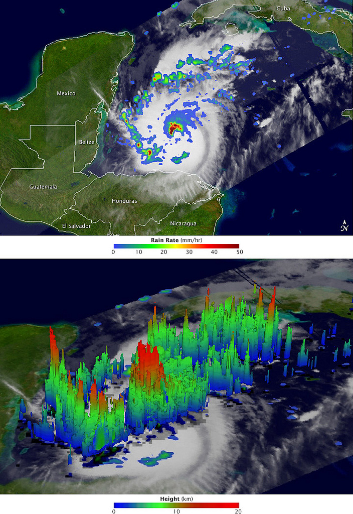
After a two-week period without any named storms, the 2011 Atlantic hurricane season revived in late October with the arrival of Hurricane Rina. The storm, which began as a tropical depression on October 23 in the western Caribbean, is adding misery and destruction to a region that has been battered by heavy rain and flooding events.
The Tropical Rainfall Measuring Mission (TRMM) collected these images of Rina at 8:06 Universal Time (3:06 am Central Daylight Time) on October 26, 2011, while located about 200 miles (330 kilometers) east of Belize. The top image shows a nadir, or straight down, view of rain intensities within Rina. Rain rates in the center of the field of view (or swath) are measured by the TRMM Precipitation Radar (PR). Those in the outer edges of the swath come from the TRMM Microwave Imager (TMI). Rain rates are overlaid on visible and infrared data from the TRMM Visible Infrared Scanner.
Bild: NASA Earth Observatory