
Montara Oil Spill - August 25, 2009
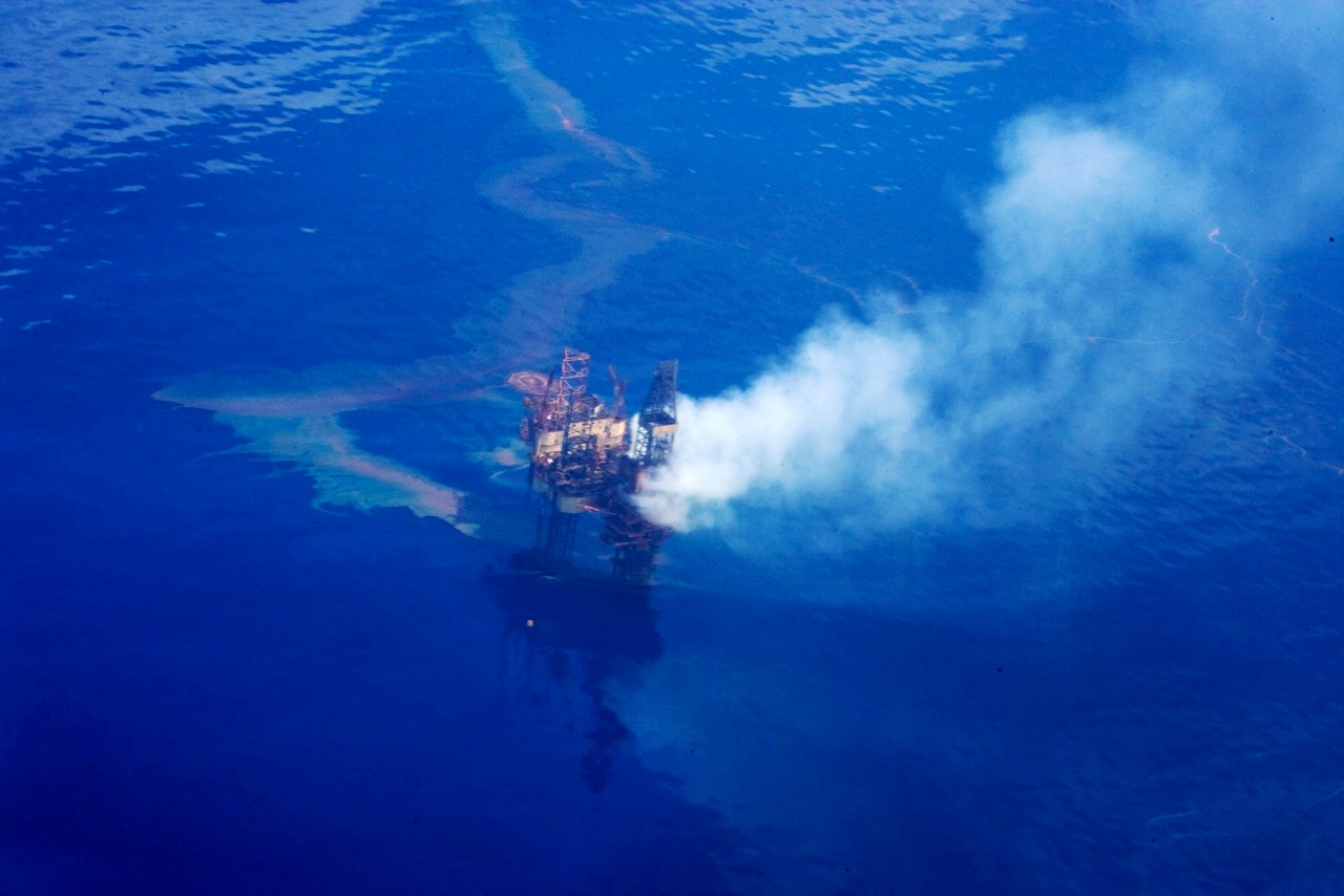
Aerial photo of the Montara offshore oil platform and West Atlas mobile drilling rig. On August 21, 2009, a well on the platform blew out as a new well was being drilled, and both the rig and the platform were imediately evacuated. Oil and gas condensate are spewing uncontrolled into the Timor Sea off Western Australia, and will continue to do so for at least 7-8 weeks until a new rig can be brought into the vicinity to drill a relief well. Photo by Chris Twomey, courtesy of WA Today.
Montara Oil Spill - August 25, 2009 | Flickr - Photo Sharing!
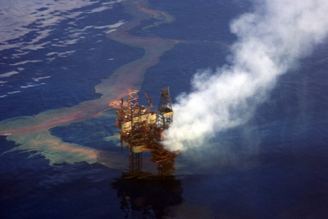
Aerial photo of the Montara offshore oil platform and West Atlas mobile drilling rig. On August 21, 2009, a well on the platform blew out as a new well was being drilled, and both the rig and the platform were imediately evacuated. Oil and gas condensate are spewing uncontrolled into the Timor Sea off Western Australia, and will continue to do so for at least 7-8 weeks until a new rig can be brought into the vicinity to drill a relief well. Photo by Chris Twomey / Australian Greens, courtesy of WA Today.
Montara Oil Platform Fire - November 1, 2009
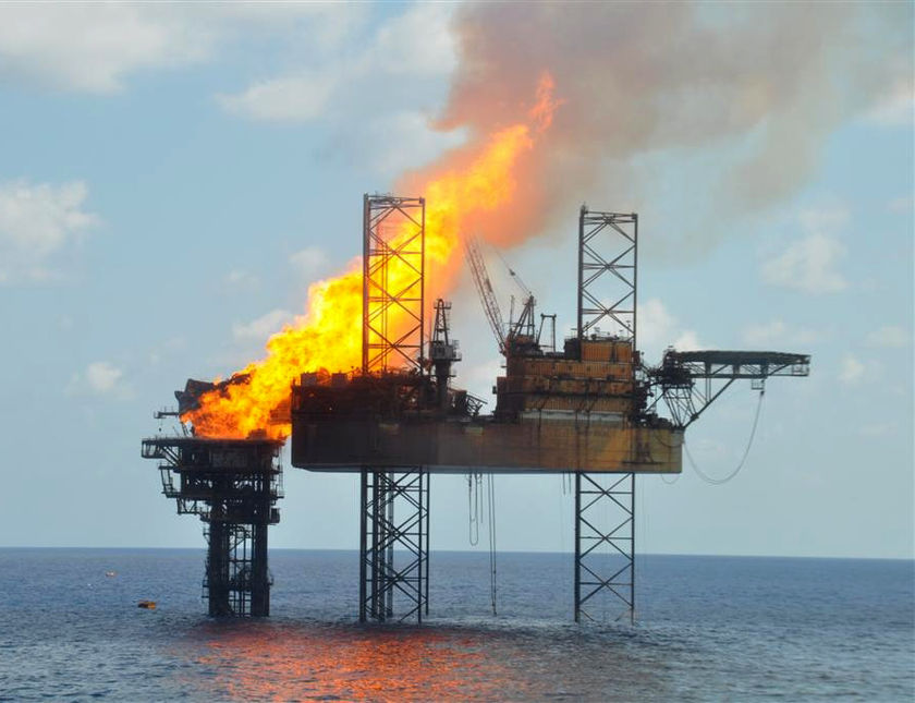
Photo of the Montara oil platform and attached West Atlas jackup drilling rig (left). Out-of-control well on the platform ignited during attempt to pump mud into the well to "kill" it. Photograph by PTTEP. Source (Australian Broadcasting Corporation News): www.abc.net.au/news/stories/2009/11/02/2731334.htm
Montara Oil Platform Fire - November 2009
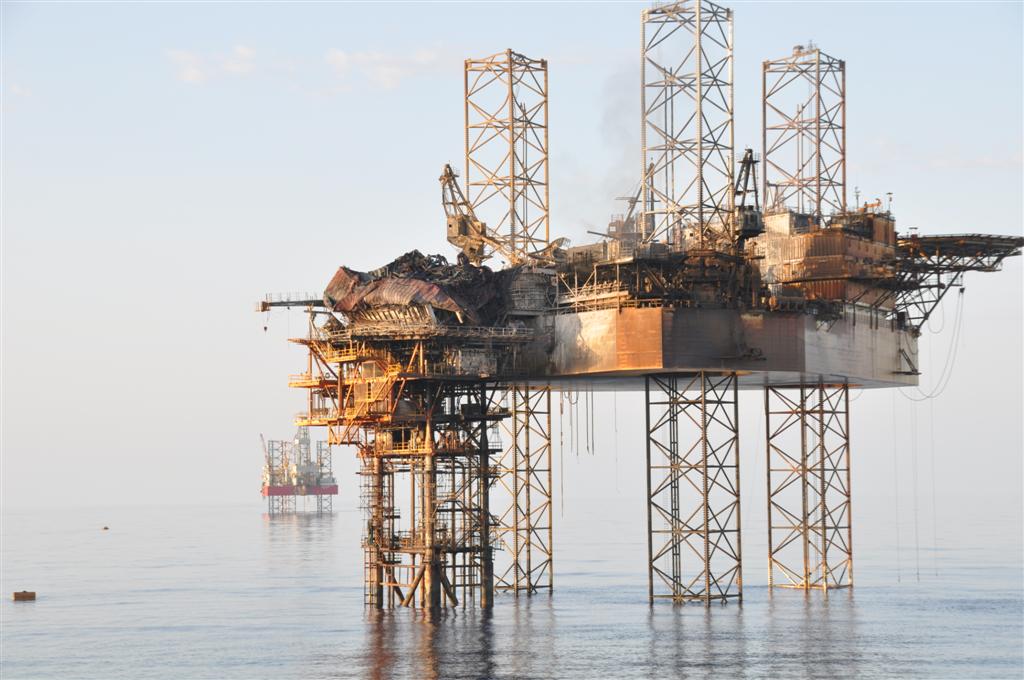
Aftermath of the fire that raged on the Montara oil platform and the attached West Atlas portable jackup drill rig on November 1-3. Photograph taken shortly after the fire burned itself out. The West Atlas rig (left foreground) is apparently a total loss.
Montara Spill - MODIS Detail (with interpretation), August 30, 2009
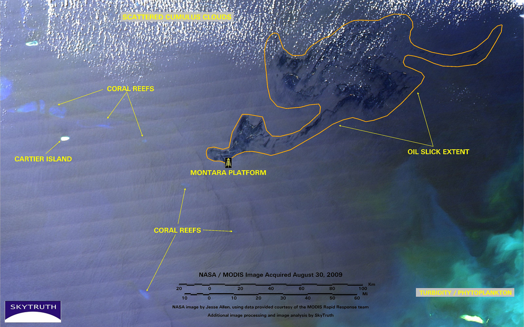
Detail from NASA / MODIS satellite image taken on August 30, 2009, showing slicks and sheen from the Montara / West Atlas offshore oil well blowout. Montara platform location provided by Australian Maritime Safety Authority (AMSA). Dark patches are oil slicks and sheen, covering over 2,500 square miles of ocean (delineated by orange line). Scattered white clouds stipple the upper part of the image, and turbid water - possibly laden with phytoplankton - creates the striking aqua color at lower right. Submerged coral reefs appear as pale blue blobs, mostly on the left half of the image.
NASA image by Jesse Allen, using data provided courtesy of the MODIS Rapid Response team, with additional processing and image analysis by SkyTruth.
Montara Oil Spill - CSK Radar, August 28, 2009 - Location Map
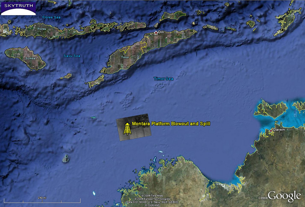
Map showing location of radar satellite image taken on August 28, 2009. CSK radar image provided by CSTARS, courtesy of e-GEOS and ASI/Telespazio.
Bild: SkyTruth