
Smoke Plume from Burning Oil Rig in Gulf of Mexico (April 21, 2010)
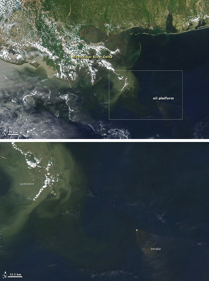
On April 20, 2010, an oil rig explosion in the Gulf of Mexico left a dozen workers missing and several more critically injured and started a large fire that was churning out smoke days later. This image of the Gulf Coast and near-shore waters was captured by the Moderate Resolution Imaging Spectroradiometer (MODIS) on NASA’s Aqua satellite on April 21.
Oil Leak from Damaged Well in Gulf of Mexico (April 25, 2010)
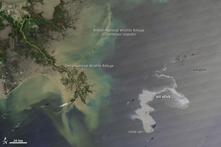
An estimated 42,000 gallons of oil per day were leaking from an oil well in the Gulf of Mexico in late April, following an explosion at an offshore drilling rig on April 20, 2010. The rig eventually capsized and sank.
These images of the affected area were captured on April 25 by the Moderate Resolution Imaging Spectroradiometer (MODIS) on NASA’s Aqua satellite.
Explosion, Leak at Gulf of Mexico Oil Well ( April 27, 2010)
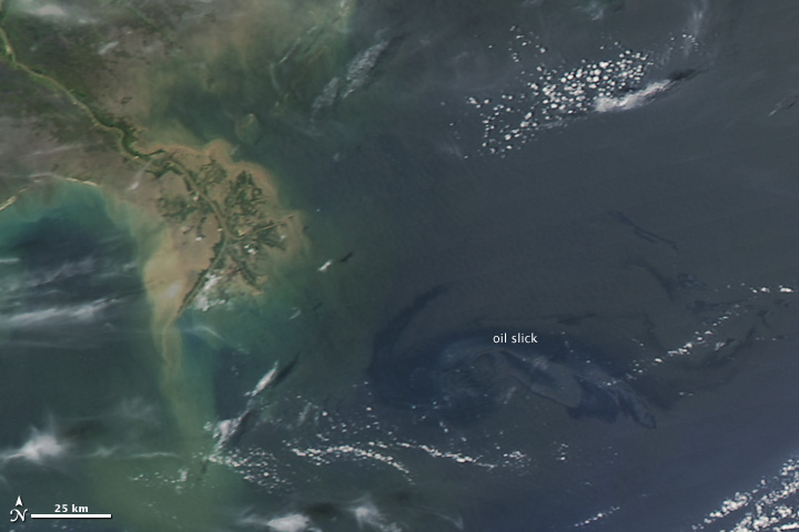
As an oil slick in the Gulf of Mexico came within 20 miles of barrier islands and beaches in Louisiana, the U.S. Coast Guard announced plans to begin setting fire to the leaked oil to reduce the amount that can contaminate ecologically sensitive areas. News reports said that burning could begin Wednesday.
This image of the slick was captured on Tuesday, April 27, 2010, by the Moderate Resolution Imaging Spectroradiometer (MODIS) on NASA’s Aqua satellite. Although the slick is less obvious than it was in earlier images, that is not necessarily a sign that it is smaller or more dispersed. The ability to detect oil slicks in photo-like satellite images is very sensitive to the viewing geometry—the angles between the surface, the Sun, and the satellite—at the time of the image. If the slick happens to be located in the sunglint part of the image, it may be very visible, but if not, it can be faint or even impossible to see.
Gulf Oil Spill Creeps Towards Mississippi Delta (April 29, 2010)
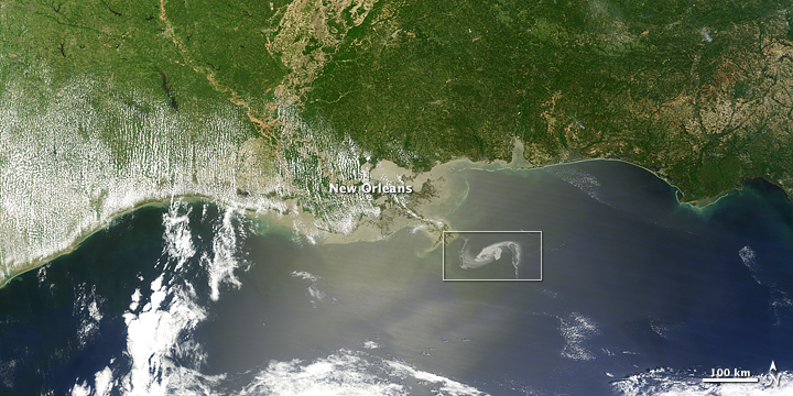
A massive oil slick in the Gulf of Mexico continued spreading on April 29, 2010, moving perilously close to shore, according to news reports. As the oil slick spread, the U.S. Coast Guard attempted controlled burns on some of the oil to prevent its spread, but had to halt the process due to high winds. Meanwhile, the U.S. National Oceanic and Atmospheric Administration constructed a dome-and-pipe system to contain the spread of oil at the sea floor.
The Moderate Resolution Imaging Spectroradiometer (MODIS) on NASA’s Terra satellite captured a natural-color image of the oil slick just off the Louisiana coast.