
Ölpest
Seaswarm: autonome Roboterschwärme
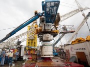
Doug Suttles visits ROV (Remote Operated Vehicle) vessel

Doug Suttles visits ROV (Remote Operated Vehicle) vessel Ocean Intervention III in Port Fourchon 22 July 2010.
Bild: BP America
BP America – Flickr
-
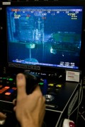
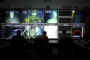
- ROV (remote operated vehicle) control room 1

-

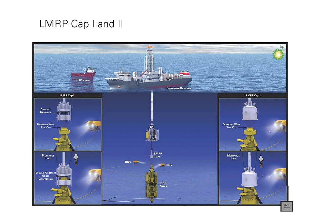
- LMRP (Lower Marine Riser Package) Cap I and II
uscgd8 – Flickr
-

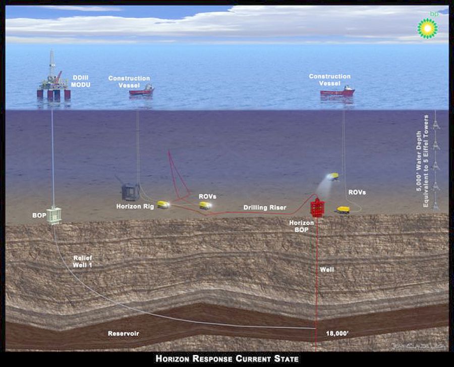
- 2010-04-27 BP_Horizon Response Current State(2)
-

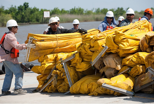
- Contracted workers from U.S. Environmental Services organize boom for deployment
-
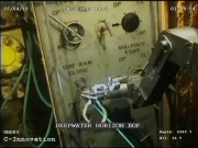
- ROV attempting to activate Deepwater Horizon Blowout Preventer
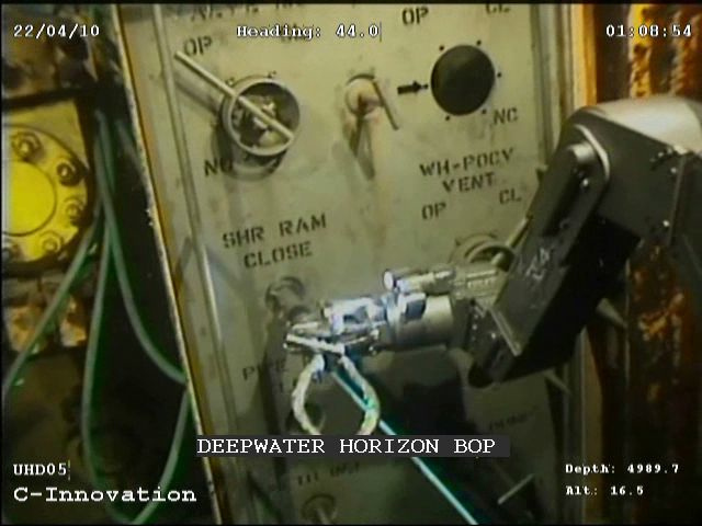
Bild: uscgd8
BP
Deepwater Horizon Oil Spill – MODIS/Aqua Detail (with interpretation), July 28, 2010
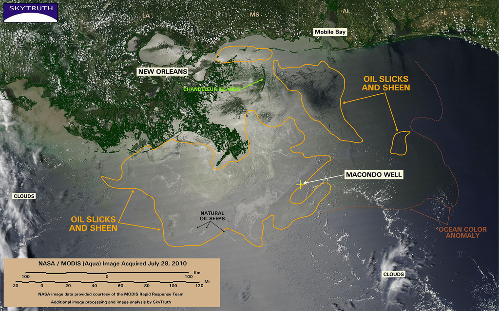
This MODIS / Aqua satellite image taken at 2 pm Central time on July 28, 2010, shows oil slicks and sheen (encircled with orange line), that are likely attributable to the BP / Deepwater Horizon oil spill, spread out across 11,832 square miles (30,644 km2) in the Gulf of Mexico. Given the steady dissipation in the oil slick that we've observed on satellite imagery over the past few days, and reports from the Coast Guard and independent observers, we are assuming that most of this is very thin sheen.
We've marked the eastern edge of a persistent ocean-color anomaly with a dashed line; this anomaly may simply be related to the Mississippi River discharge, or could indicate an area where ocean chemistry has been affected by oil, dispersant, and/or dissolved methane from the spill and cleanup response.
Three small slicks attributable to natural oil and gas seeps are also marked.
Bild: SkyTruth
NASA’s Terra Satellites Sees Spill on May 24
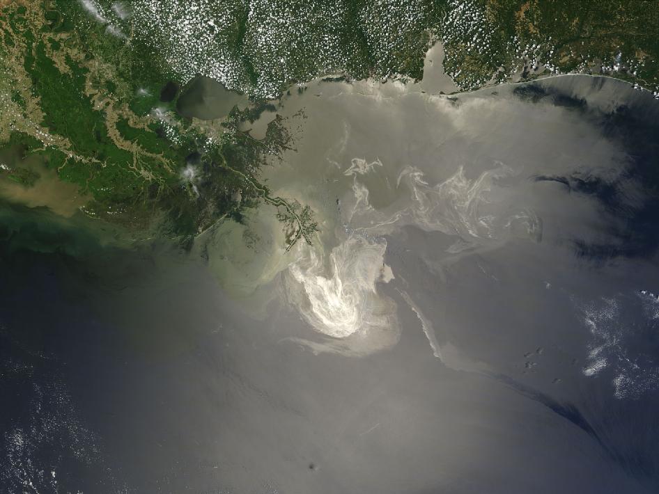
Sunlight illuminated the lingering oil slick off the Mississippi Delta on May 24, 2010. The Moderate Resolution Imaging Spectroradiometer (MODIS) on NASA’s Terra satellite captured this image the same day.
Oil smoothes the ocean surface, making the Sun’s reflection brighter near the centerline of the path of the satellite, and reducing the scattering of sunlight in other places. As a result, the oil slick is brighter than the surrounding water in some places (image center) and darker than the surrounding water in others (image lower right). The tip of the Mississippi Delta is surrounded by muddy water that appears light tan. Bright white ribbons of oil streak across this sediment-laden water.
Tendrils of oil extend to the north and east of the main body of the slick. A small, dark plume along the edge of the slick, not far from the original location of the Deepwater Horizon rig, indicates a possible controlled burn of oil on the ocean surface.
To the west of the bird’s-foot part of the delta, dark patches in the water may also be oil, but detecting a manmade oil slick in coastal areas can be even more complicated than detecting it in the open ocean.
When oil slicks are visible in satellite images, it is because they have changed how the water reflects light, either by making the Sun’s reflection brighter or by dampening the scattering of sunlight, which makes the oily area darker. In coastal areas, however, similar changes in reflectivity can occur from differences in salinity (fresh versus salt water) and from naturally produced oils from plants.
Michon Scott
NASA's Earth Observatory
NASA Goddard Space Flight Center
Exxon Valdez Oil Spill Trustee Council –
-
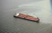
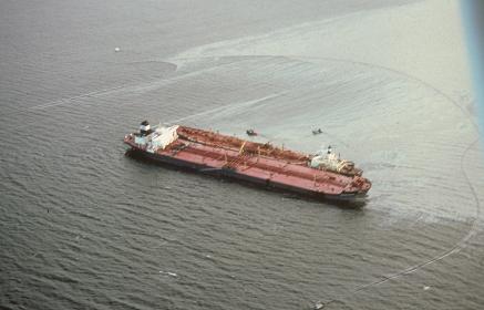
- Exxon Valdez tanker leaking oil.
-
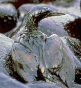
- Oiled cormorant on a rocky oil-covered shore

-

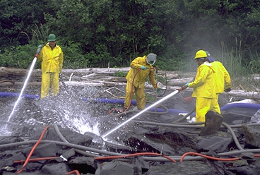
- Clean-up workers spray oiled rocks with high pressure hoses.
Aerial photographs taken of booming operations 1
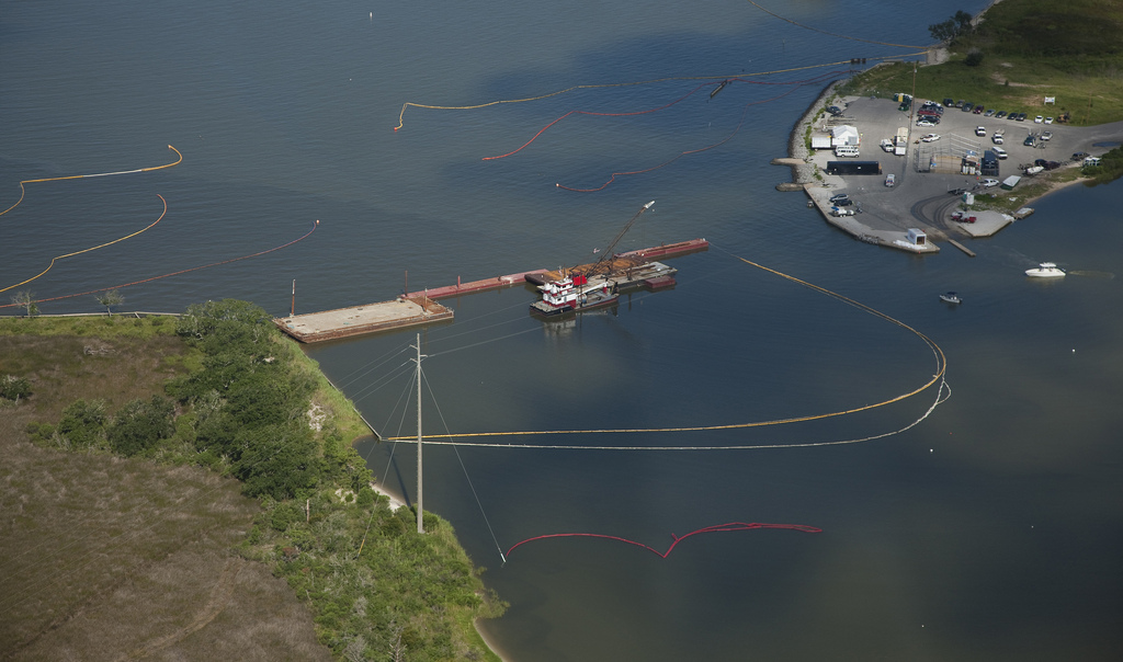
Aerial photographs taken of booming operations and shoreline between Mobile, AL and Perdido Pass on Tuesday, 27 July 2010.
Bild: BP America
Altered Image of HIVE Command Center
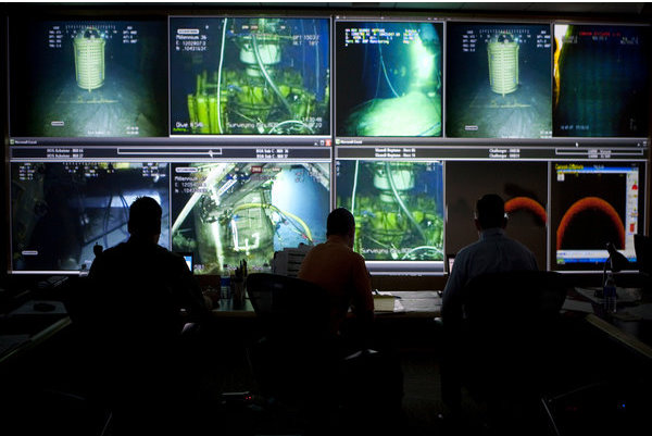
Bild: BP America
Das von BP retouchierte Foto, das an die Presse gegeben wurde
BP America – Flickr
-

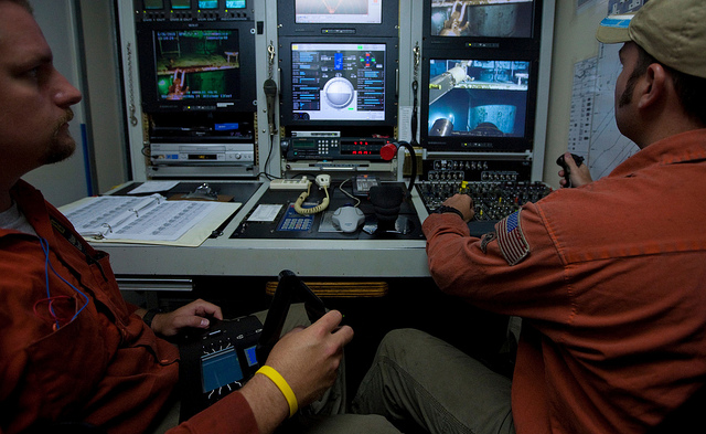
- HIVE ROV Control Room 1

-
- Images from the bridge OnBoard Q4000 during the "Static Kill"

-

- ROV Shack onboard the Transocean Development Drille
-
- Capping stack BOP is being readied for shipment 1

-

- Sim Ops Original Image

-

- Altered Image of Sim Ops Room

-
- Original Image of HIVE Command Center

Deepwater Horizon Response – Flickr
-
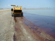
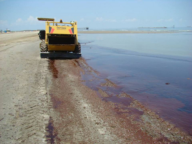
- Beach Clean-Up Vehicles
-
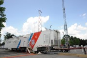
- Enhanced Mobile Incident Command Post

-

- Enhanced Mobile Incident Command Post

lagohsep – Flickr
-

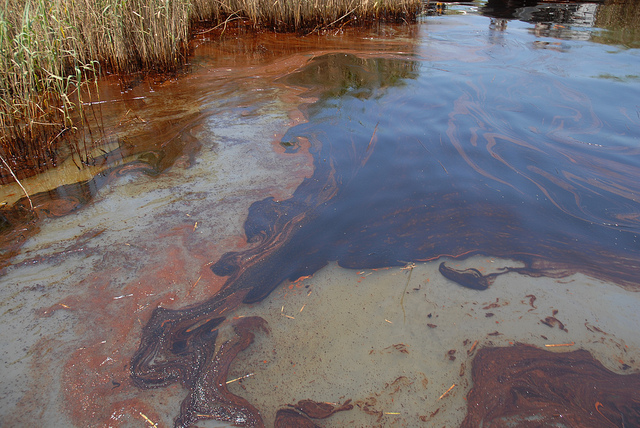
- Oil Impacts PAL, May 19, 2010
-

- Oiled Pelicans
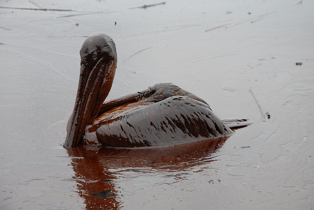
Bild: lagohsep
Mississippi Canyon May 20 1800IM
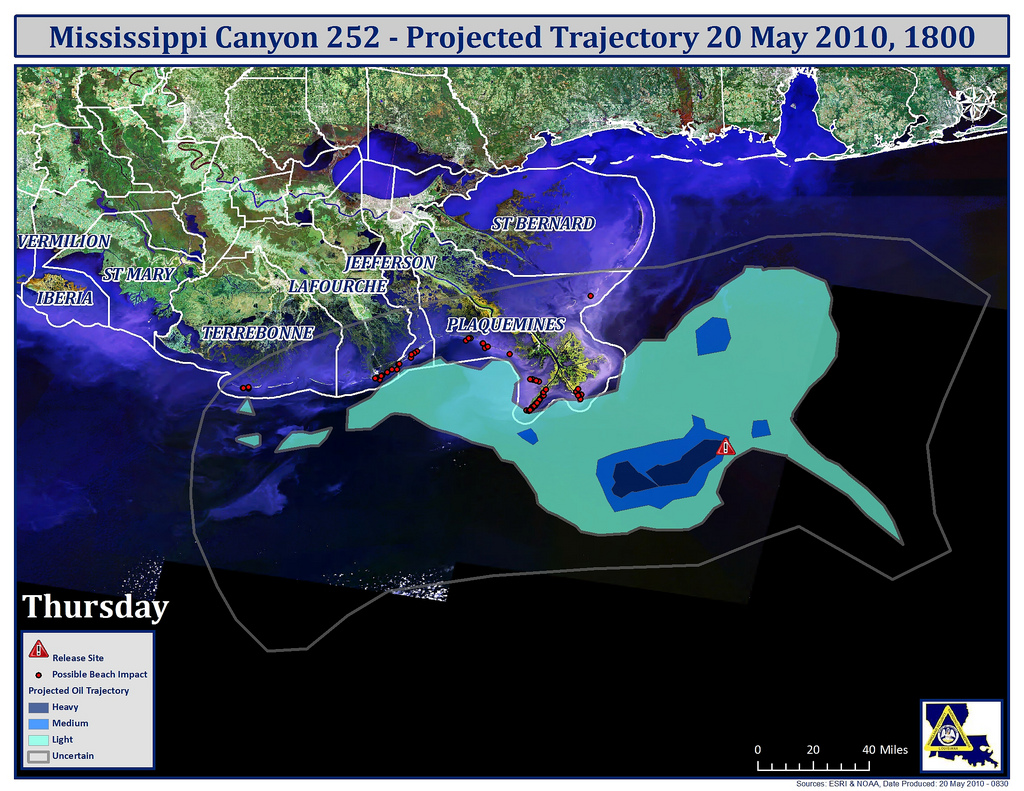
Bild: lagohsep