
NASA (National Aeronautics and Space Administration)
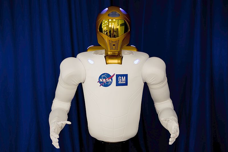
Robonaut2
Mount St. Helens: Thirty Years Later [HD Video] | Flickr – Fotosharing!
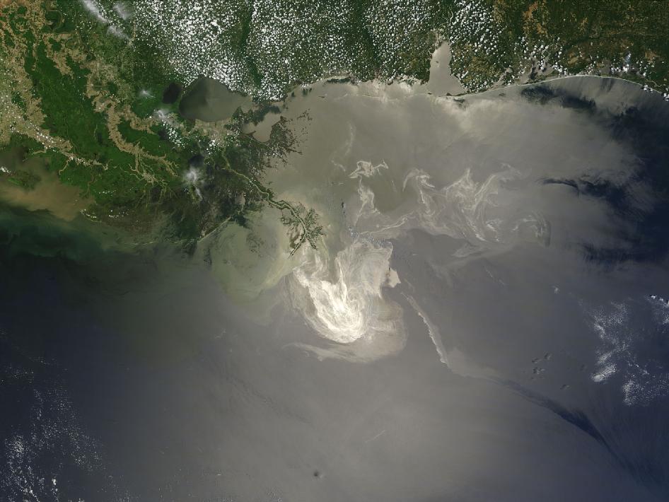
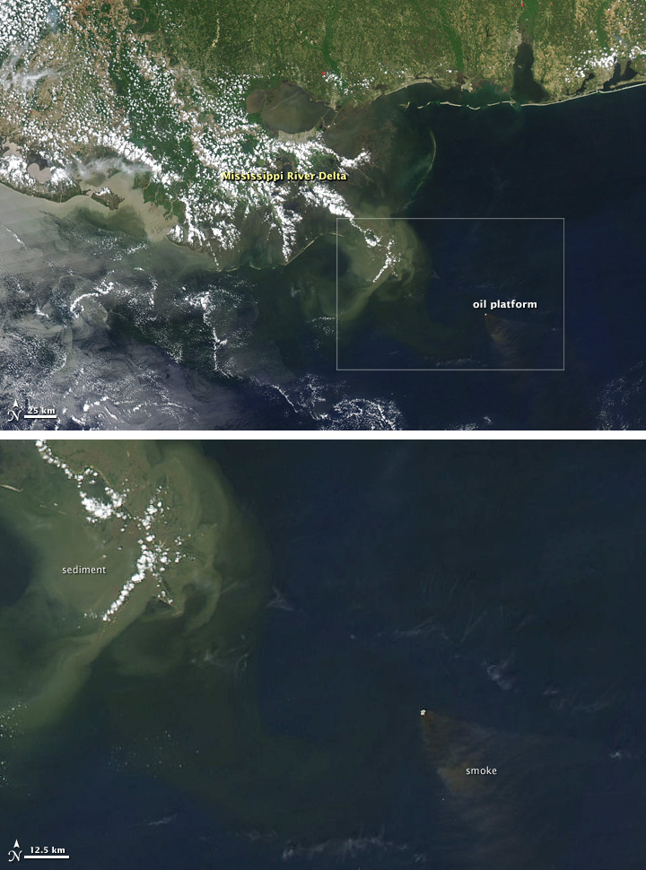
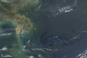
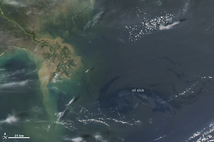
NASA’s Terra Satellites Sees Spill on May 24
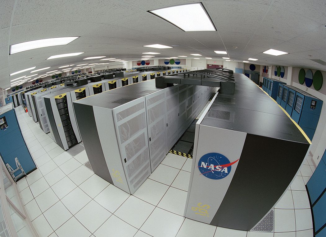
NASA Center for Climate Simulation Debuts 2
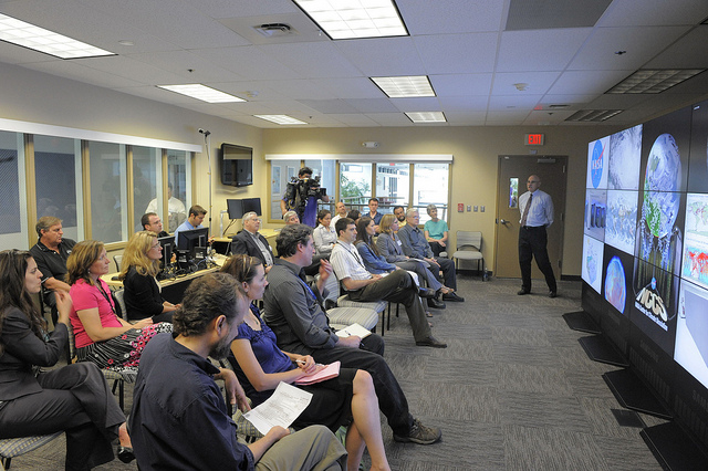
NASA Center for Climate Simulation Debuts
The NCCS media day was attended by members of the media and NCCS partners from industry and government. Dr. Phil Webster (right, center) addresses the audience.
To learn more go to: www.nasa.gov/topics/earth/features/climate-sim-center.html
Credit: NASA/GSFC/Pat Izzo
NASA Goddard Space Flight Center is home to the nation’s largest organization of combined scientists, engineers and technologists that build spacecraft, instruments and new technology to study the Earth, the sun, our solar system, and the universe.
NASA Center for Climate Simulation Debuts 3
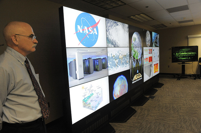
NASA Center for Climate Simulation Debuts
The cornerstone of the NASA Center for Climate Simulation is its 15-screen visualization wall. Dr. Phil Webster (left) presents a variety of visuals on the wall.
To learn more go to: www.nasa.gov/topics/earth/features/climate-sim-center.html
Credit: NASA/GSFC/Pat Izzo
NASA Goddard Space Flight Center is home to the nation’s largest organization of combined scientists, engineers and technologists that build spacecraft, instruments and new technology to study the Earth, the sun, our solar system, and the universe.
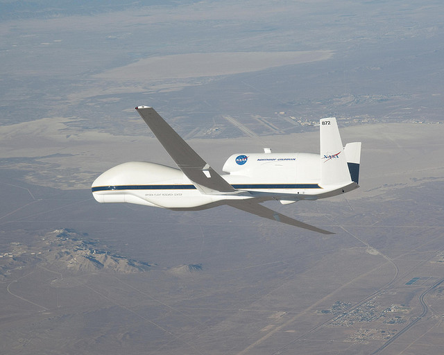
Global Hawk, NASA’s New Remote-Controlled Plane
Stephen Hawking NASA 50th

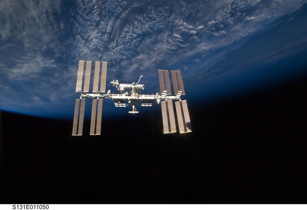
Earth and International Space Station (NASA, 04/17/10)
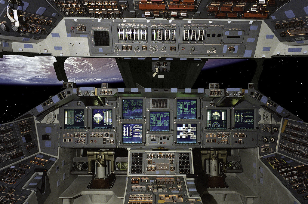
NASA faked Shuttle picture!
NASA’s new learning initiative unveiled
NASA Earth Observatory
-
- Smoke Plume from Burning Oil Rig in Gulf of Mexico (April 21, 2010)
-
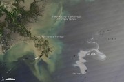
- Oil Leak from Damaged Well in Gulf of Mexico (April 25, 2010)
-
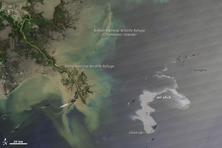
- Explosion, Leak at Gulf of Mexico Oil Well ( April 27, 2010)
-
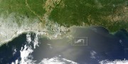
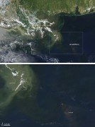
- Gulf Oil Spill Creeps Towards Mississippi Delta (April 29, 2010)

The Columbia Supercomputer at NASA’s Advanced Supercomputing Facility at Ames Research Center