
Hochwasser
16.08.2011 · Es gibt sie im Elektromarkt, aber im Journalismus sind sie noch nicht angekommen. Dabei sind Mini-Drohnen als fliegende Paparazzi wie geschaffen für die Recherchemethoden des Boulevardjournalismus.
Homes flooded in Minot, North Dakota (June 28, 2011)
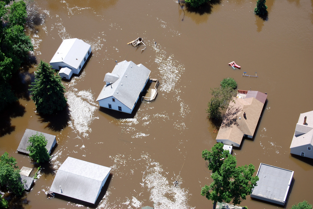
MINOT, North Dakota — Aerial photo of Minot, N.D., flooded from the Souris River, June 28, 2011. The U.S. Army Corps of Engineers St. Paul District is assisting the North Dakota communities in the Souris River basin fighting record flooding. (U.S. Army Corps of Engineers photo by Clay Church)
Bild: USACEpublicaffairs
Satellitenkarte der überfluteten Fläche im Landkreis Märkisch-Oderland

Satellitenkarte der überfluteten Fläche im Landkreis Märkisch-Oderland, Deutschland, aus TerraSAR-X Daten vom 28. Mai 2010 - Übersicht 1:50.000
Bild: Karte DLR - ZKI
Satellitenkarte der überfluteten Fläche im Landkreis Märkisch-Oderland, Deutschland, aus TerraSAR-X Daten vom 28. Mai 2010 – Übersicht 1:50.000