Weitere Unterabschnitte: aktuelle Daten | Satelliten | Klimawandel | Erdbeben - Tsunami
Allgemeines
Klarer Fall
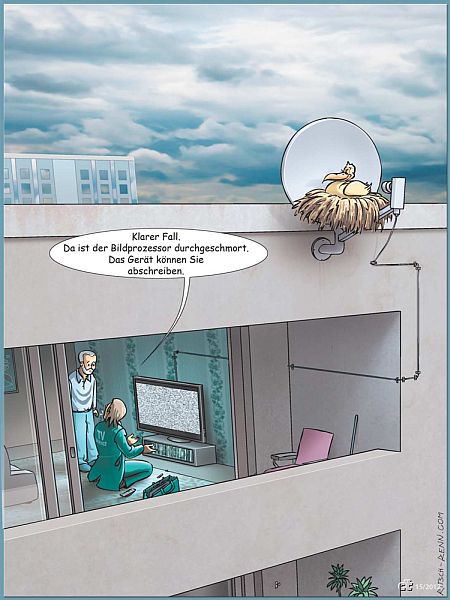
Bild: Verkleinertes Original mit freundlicher Genehmigung Ritsch & Renn
Die unberechtigte Nutzung ist nicht gestattet.
Die unberechtigte Nutzung ist nicht gestattet.
Ars Electronica – Flickr
-
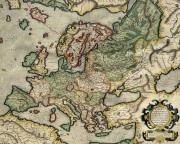
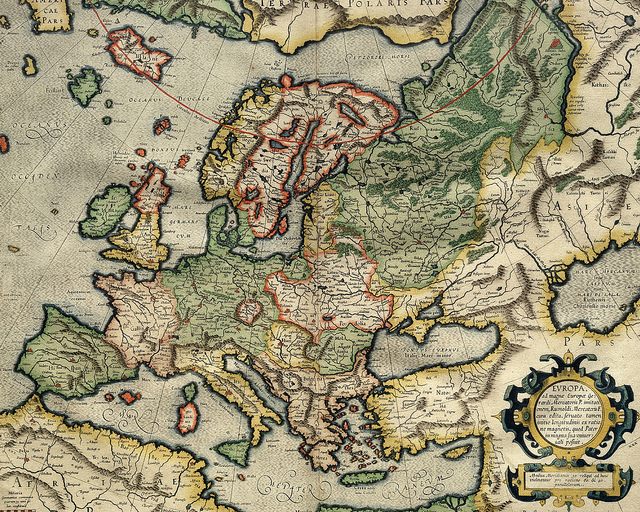
- Mercator map of Europe
-

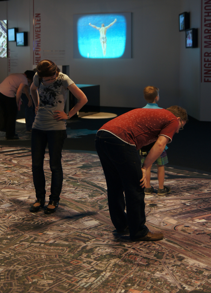
- Linz von oben
-
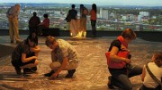
- Linz von oben, Panorama
Bild: Ars Electronica
Google Doodle: Oct 04, 1957 Sputnik

Pazifik: Forscher entdecken riesigen Wasserhügel – SPIEGEL ONLINE
Credits: ESA - GOCE High Level Processing Facility
ESA Portal
-

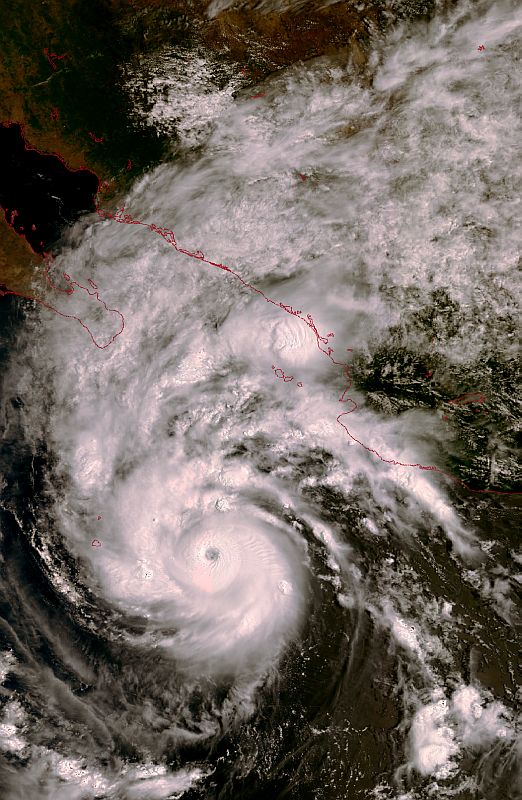
- Hurricane Jimena roaring towards Mexico’s Baja California Peninsula on 31 August 2009
-
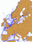
- Shipping routes clearly correspond to the pattern of detected NO2.
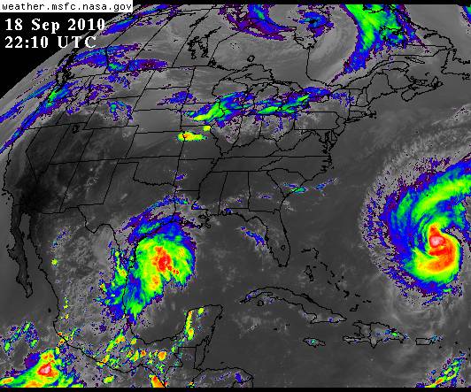
AG Satellitenmeteorologie
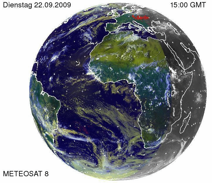
Meteosat-2 artificially-coloured visible channel full-disc Earth image.

Meteosat-2 artificially-coloured visible channel full-disc Earth image. Developed by ESA and since 1995 operated by EUMETSAT, Meteosat has been routinely returning Earth imagery from geostationary orbit since 1977.
earthhopper – Flickr
-
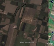
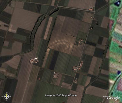
- Roman Ruins found by Google Earth / Google Maps
-
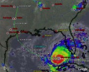
- Hurricane Rita Tracker
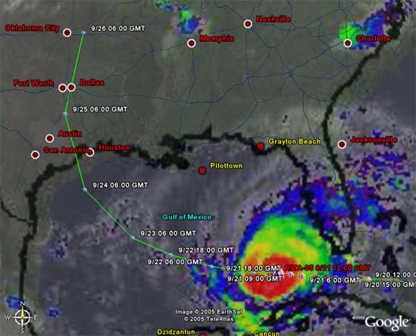
Bild: earthhopper
Satellitenkarte der überfluteten Fläche im Landkreis Märkisch-Oderland, Deutschland, aus TerraSAR-X Daten vom 28. Mai 2010 – Übersicht 1:50.000
Satellitenkarte der überfluteten Fläche im Landkreis Märkisch-Oderland

Satellitenkarte der überfluteten Fläche im Landkreis Märkisch-Oderland, Deutschland, aus TerraSAR-X Daten vom 28. Mai 2010 - Übersicht 1:50.000
Bild: Karte DLR - ZKI
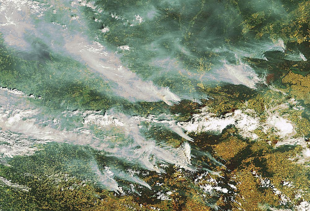
Earth from Space: Smoke over Moscow
NASA Center for Climate Simulation Debuts 3
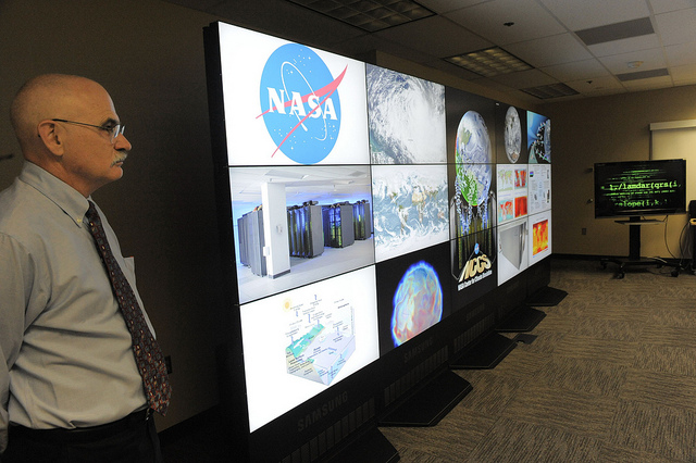
NASA Center for Climate Simulation Debuts
The cornerstone of the NASA Center for Climate Simulation is its 15-screen visualization wall. Dr. Phil Webster (left) presents a variety of visuals on the wall.
To learn more go to: www.nasa.gov/topics/earth/features/climate-sim-center.html
Credit: NASA/GSFC/Pat Izzo
NASA Goddard Space Flight Center is home to the nation’s largest organization of combined scientists, engineers and technologists that build spacecraft, instruments and new technology to study the Earth, the sun, our solar system, and the universe.
NASA Center for Climate Simulation Debuts 2
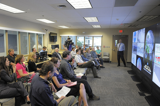
NASA Center for Climate Simulation Debuts
The NCCS media day was attended by members of the media and NCCS partners from industry and government. Dr. Phil Webster (right, center) addresses the audience.
To learn more go to: www.nasa.gov/topics/earth/features/climate-sim-center.html
Credit: NASA/GSFC/Pat Izzo
NASA Goddard Space Flight Center is home to the nation’s largest organization of combined scientists, engineers and technologists that build spacecraft, instruments and new technology to study the Earth, the sun, our solar system, and the universe.