
Weitere Unterabschnitte: aktuelle Daten | Satelliten | Klimawandel | Erdbeben - Tsunami
Natur und Technik
Erdbeben - Tsunami
Epizentrum des Erdbebens und Ausbreitung des Tsunamis (2004)
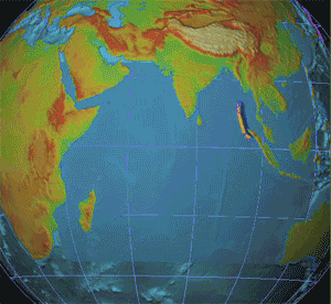
Epizentrum des Erdbebens und Ausbreitung des Tsunamis (Erdbeben im Indischen Ozean 2004)
NOAA (public domain)
Klimawandel
TIME FOR CHANGE! – Greenpeace vandalizes the Nasca Lines
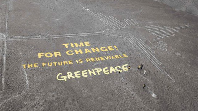
Greenpeace vandalizes the Nasca Lines/Atentado de Greenpeace contra el patrimonio cultural de Perú y de la humanidad.
Bild: A.Davey
Erdbeben - Tsunami
j808armada – Flickr
-
- japan__87_
-

- japan__86_
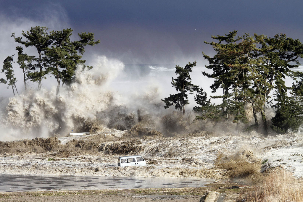
Bild: j808armada
Klimawandel
Anflug auf Doha

Anflug auf Doha (Klaus Stuttmann Karikaturen - 26.11.2012)
Bild: Verkleinertes Original mit freundlicher Genehmigung Klaus Stuttmann
Die unberechtigte Nutzung ist nicht gestattet.
Die unberechtigte Nutzung ist nicht gestattet.
8. Dezember 2012 – Es ist ein Mini-Kompromiss: Die fast 200 Teilnehmerstaaten des Welt-Klimagipfels haben sich darauf geeinigt, das Kyoto-Protokoll bis 2020 zu verlängern. Doch die größten Klimasünder wollen sich an der Bekämpfung der Erderwärmung nicht beteiligen.
West Bay in Doha, Qatar, seen from across Doha Bay
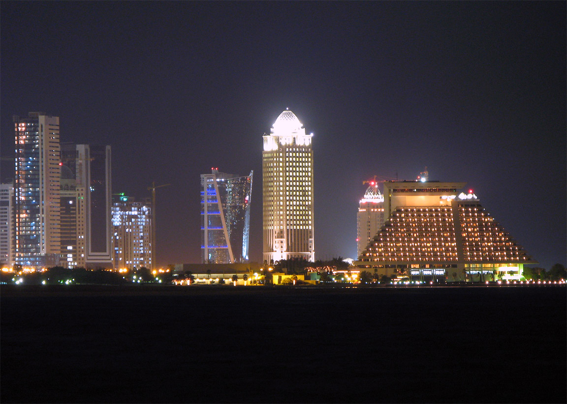
Bild: Amjra
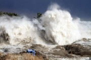
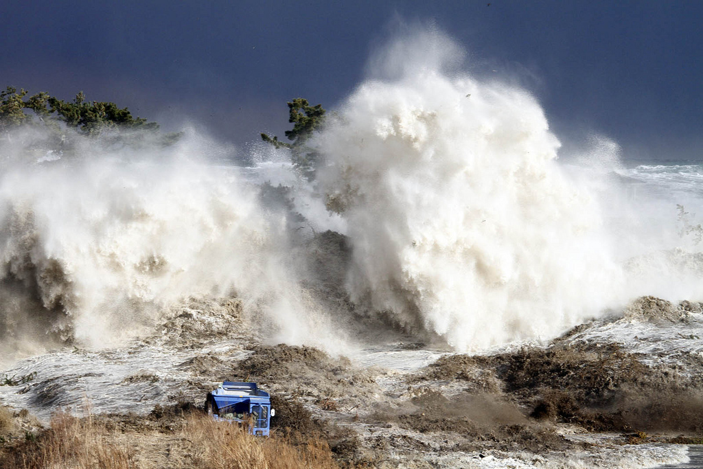
Erdbeben - Tsunami
Aerial of Minato, Japan.
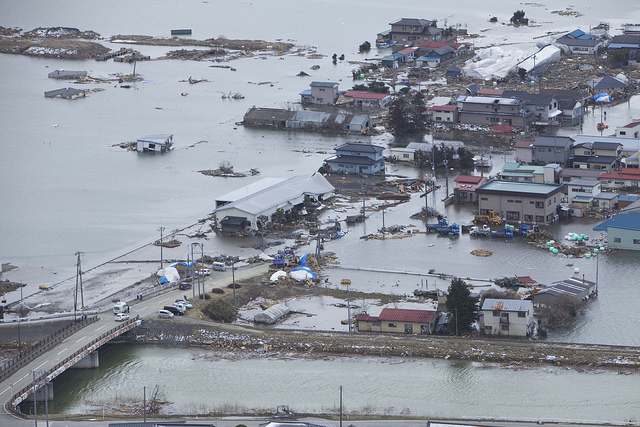
MINATO, Japan (March 18, 2011) An aerial view of Minato, Japan, a week after a 9.0 magnitude earthquake and subsequent tsunami devastated the area. (U.S. Marine Corps photo by Lance Cpl. Ethan Johnson/Released)
SandoCap – Flickr
-
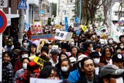
- Anti nuclear power protests in Kouenji on April 10, 2011
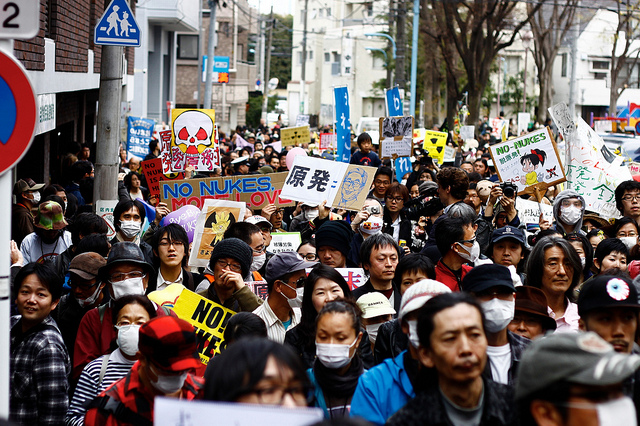
-

- Anti nuclear power protests in Kouenji on April 10, 2011 (2)
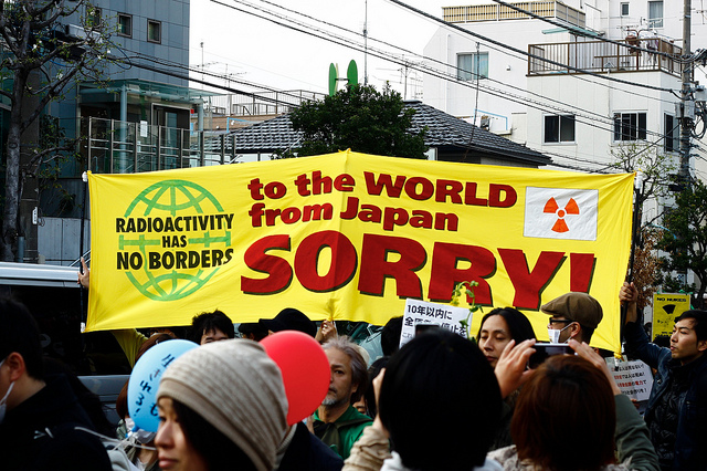
-
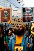
- Anti nuclear power protests in Kouenji on April 10, 2011 (3)
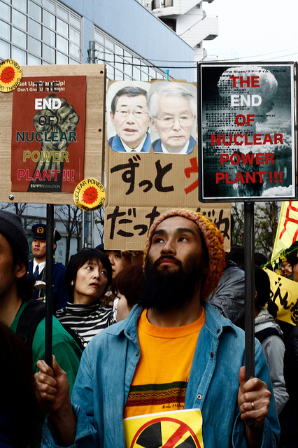
Bild: SandoCap
Raumfahrt
Aktuelle Tweets zum Weltraum
Klimawandel
Aqueduct Map
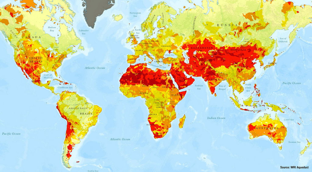
Aqueduct provides businesses, governments, and other decision makers with the highest-resolution, most up-to-date data on water risk across the globe. Armed with this information, these decision-makers can better understand how water risk impacts them—and hopefully, take actions to improve water security.
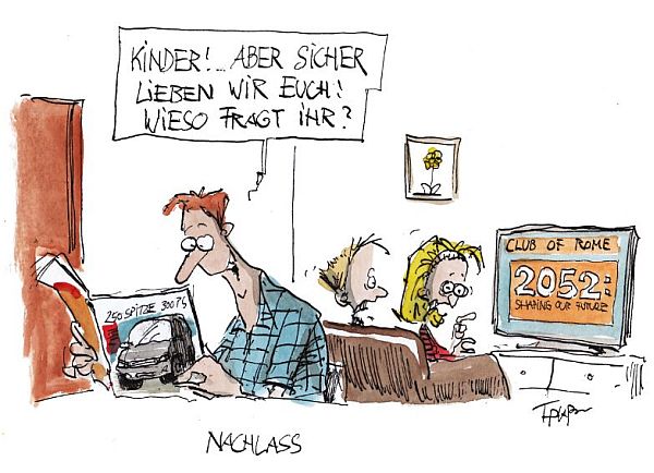
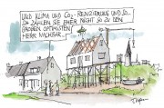
Thomas Plaßmann – Karikaturen. Cartoons. Ideen
-

- Nachlass
-
- Klimawandel…
-

- Klimagespräche

Bild: Verkleinertes Original mit freundlicher Genehmigung Thomas Plaßmann
Die unberechtigte Nutzung ist nicht gestattet.
Die unberechtigte Nutzung ist nicht gestattet.
Raumfahrt
Rogue Satellite Update

Soyuz dry-run (time-lapse) – ESA Online Videos

Erdbeben - Tsunami
Unterwasser-Vulkan: Tauchroboter filmt Ausbruch – SPIEGEL ONLINE
Raumfahrt
50 Years In Space: Was It Worth It? [INFOGRAPHIC & POLL]
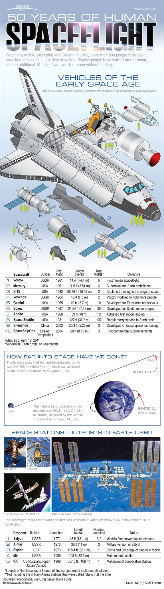
Bild: mashable.com/
space.com
space.com
Global Positioning System (GPS)
GPS-Störsender…
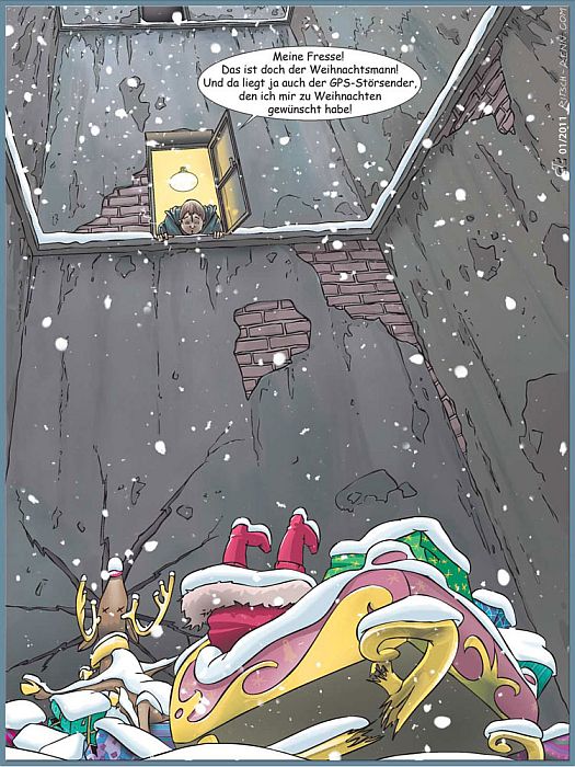
Bild: Verkleinertes Original mit freundlicher Genehmigung Ritsch & Renn
Die unberechtigte Nutzung ist nicht gestattet.
Die unberechtigte Nutzung ist nicht gestattet.
Klimawandel
Arabs; take the lead! Qatar climate march
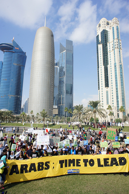
Climate activists gathered for a march on the waterfront in Doha; calling on Arab countries to take the lead in UN climate change negotiations.
Saturday December 1st 2012
Bild: adopt a negotiator