
Falschfarbendarstellung
Looking Inside Hurricane Rina
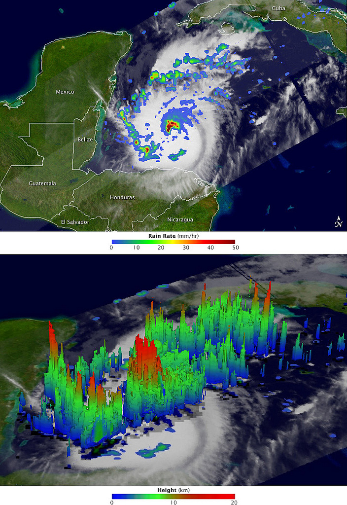
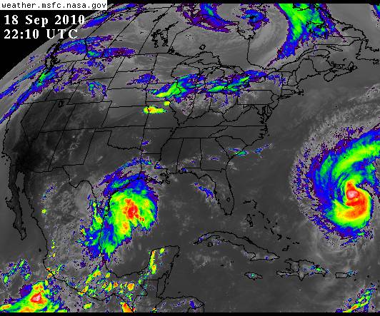
After a two-week period without any named storms, the 2011 Atlantic hurricane season revived in late October with the arrival of Hurricane Rina. The storm, which began as a tropical depression on October 23 in the western Caribbean, is adding misery and destruction to a region that has been battered by heavy rain and flooding events.
The Tropical Rainfall Measuring Mission (TRMM) collected these images of Rina at 8:06 Universal Time (3:06 am Central Daylight Time) on October 26, 2011, while located about 200 miles (330 kilometers) east of Belize. The top image shows a nadir, or straight down, view of rain intensities within Rina. Rain rates in the center of the field of view (or swath) are measured by the TRMM Precipitation Radar (PR). Those in the outer edges of the swath come from the TRMM Microwave Imager (TMI). Rain rates are overlaid on visible and infrared data from the TRMM Visible Infrared Scanner.
Bild: NASA Earth Observatory
PET scan of an healthy brain compared to a brain at an early stage of Alzheimer’s disease.
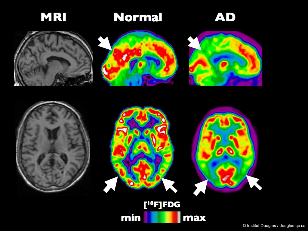
The figure shows MRI, and typical [18F]FDG images from a healthy volunteer and a Alzheimer Disease (AD) patient. The color scale express the rate of glucose utilization (from minimum to maximum). In these PET (Positron Emission Tomography) images (column 2 and 3), the white and red colors represent the regions of the brain with the highest glucose utilization rates while the green and blue represent the hypometabolic brain areas.
The arrows show the posterior temporo-parietal junction (lower row) and the posterior cingulate gyrus (top row).
Bild: Institut Douglas
maximum computed tsunami amplitude
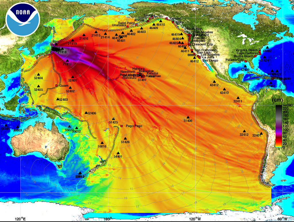
SEATTLE, WA - MARCH 11: In this handout image provided by the National Oceanic and Atmospheric Administration (NOAA), model amplitudes calculated with the MOST forecast model are seen March 11, 2011. Filled colors show maximum computed tsunami amplitude in cm during 24 hours of wave propagation. Black contours show computed tsunami arrival time. A magnitude 8.9 strong earthquake hit the northeast coast of Japan causing Tsunami alerts throughout countries bordering the Pacific Ocean. (Photo by NOAA Center for Tsunami Research via Getty Images)
Bild: Beacon Radio
Pazifik: Forscher entdecken riesigen Wasserhügel – SPIEGEL ONLINE
Credits: ESA - GOCE High Level Processing Facility
Joachim S. Müller – Flickr
-
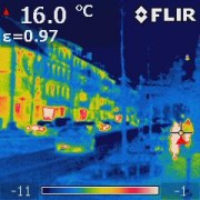
- Wärmebildaufnahme Heinheimer Straße

-
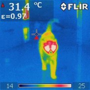
- Wärmebildaufnahme Katze

-

- Wärmebildaufnahme Lupo
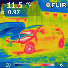
Bild: Joachim S. Müller
Strahlender Atommüll in Bild und Ton – Greenpeace
Vulkanausbruch in Island: Aschewolke zieht nach Deutschland (ESA-Animation)
CORE-Materials – Flickr
-
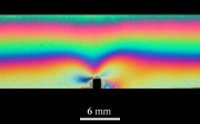
- Strain-induced birefringence in a notched polycarbonate bar

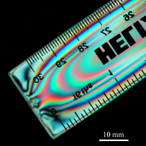
-
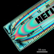
- Injection-moulded polystyrene ruler
-

- Structure of a tennis string
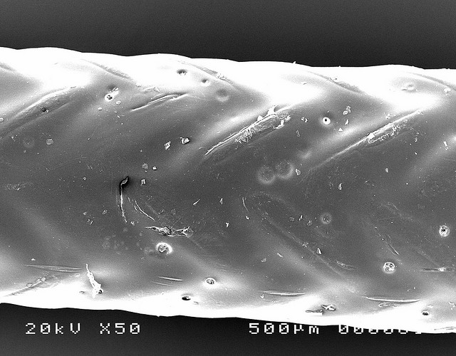
-

- Structure of a tennis string (2)
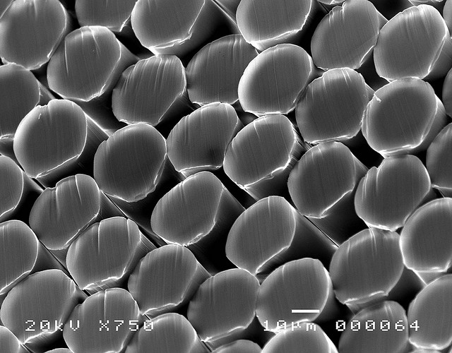
-
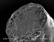
- Structure of a tennis string (3)
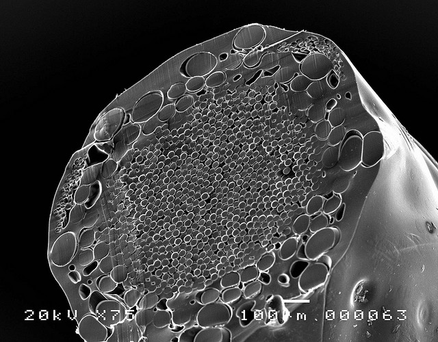
-

- Wood and CFRP tennis rackets

Bild: CORE-Materials
GOES East 1 km Infrared Weather Satellite Image
Wikipedia – Die freie Enzyklopädie
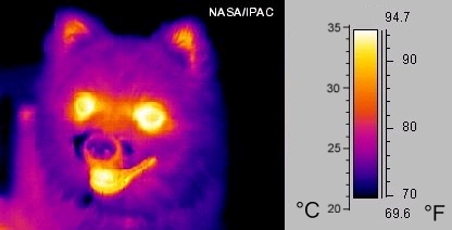
-

- Eine Infrarotfotografie (MIR, um 10 µm) eines kleinen Hundes (Falschfarbendarstellung)
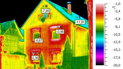
-

- Bauthermografie: ungedämmte Außenwand – Wikipedia
Luggage X-ray Scanner at Taj Mahal Hotel, New Delhi
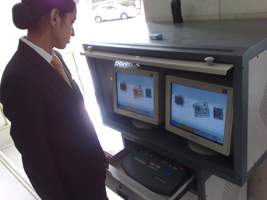
When you enter to Taj Mahal hotel in New Delhi, India, your bags are scanned and you have to walk through a metal detector. Yet both are more theatre than actual security as they don't care if you set off the metal detector and the baggage x-ray only gets a cursory look
Bild: Wayan Vota
Luggage scan
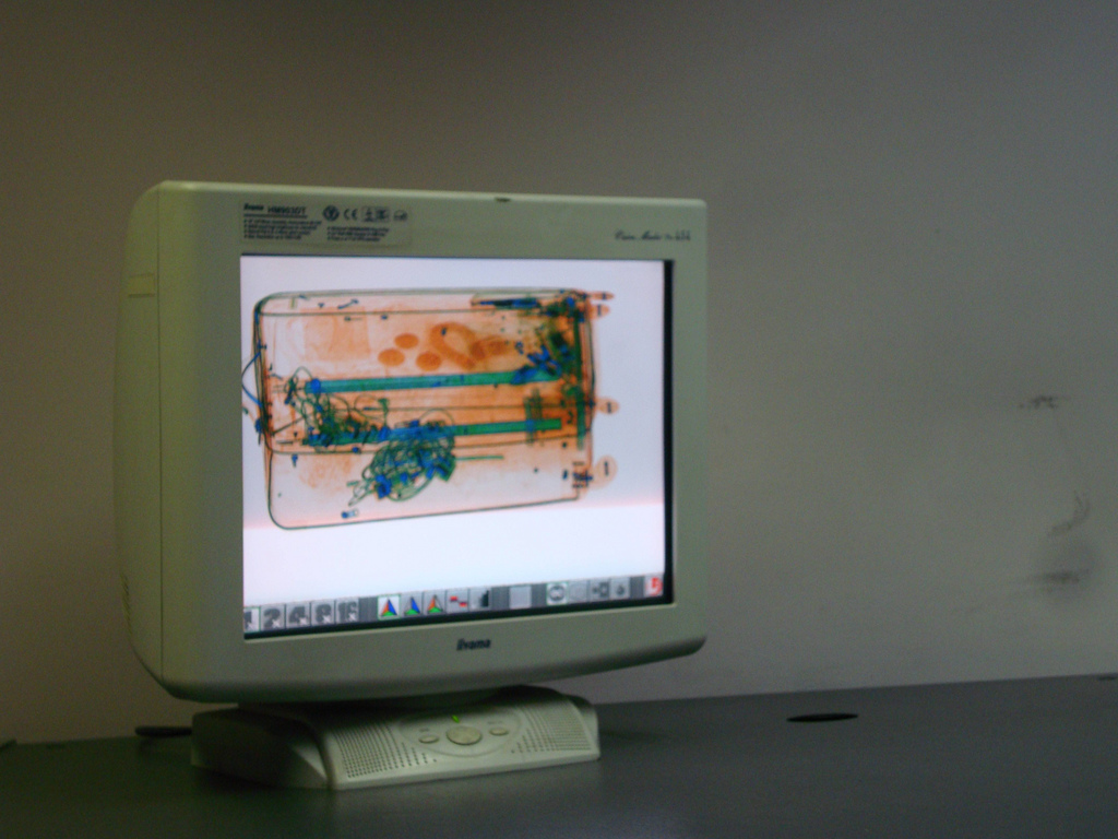
At Kings Cross left luggage, they scan your baggage, but don't object to you photographing it.
Bild: gwydionwilliams
Hurricane Katrina: A NASA Satellite Video Retrospective [HD Video]
Sun and Solar Magnetism (NASA, 3/15/10)

Solar Magnetism
NASA STEREO Captures Huge Eruptive Prominence 304 April13
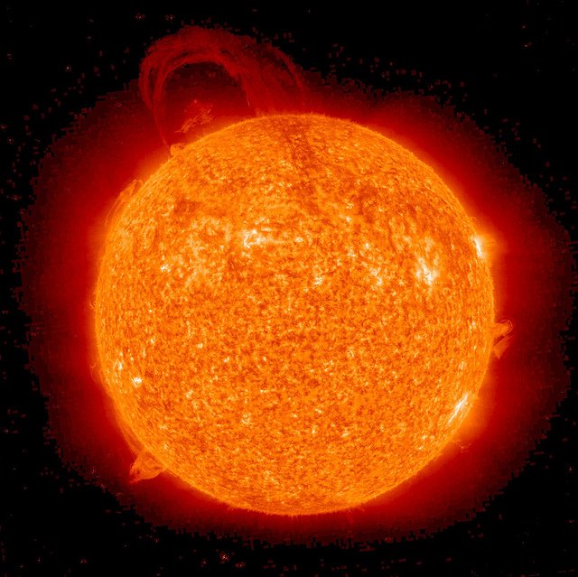
The STEREO (Ahead) spacecraft caught this spectacular eruptive prominence in extreme UV light as it blasted away from the Sun (Apr. 12-13, 2010). This was certainly among the largest prominence eruptions seen by either the STEREO or SOHO missions. The length of the prominence appears to stretch almost halfway across the sun, about 500,000 miles. Prominences are cooler clouds of plasma that hover above the Sun’s surface, tethered by magnetic forces. They are notoriously unstable and commonly erupt as this one did in a dramatic fashion. The video clip shows about 19 hours of activity.
To learn more or donwload the high res files go to: stereo.gsfc.nasa.gov/gallery/item.php?id=selects&iid=122
NASA Goddard Space Flight Center is home to the nation's largest organization of combined scientists, engineers and technologists that build spacecraft, instruments and new technology to study the Earth, the sun, our solar system, and the universe.
Ein Video dieser Protuberanzen gibt’s unter www.flickr.com/photos/gsfc/4526619234/