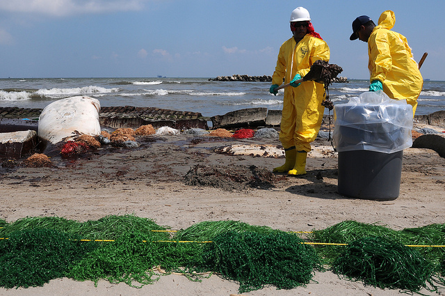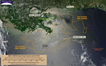
This MODIS / Aqua satellite image taken at 2 pm Central time on July 28, 2010, shows oil slicks and sheen (encircled with orange line), that are likely attributable to the BP / Deepwater Horizon oil spill, spread out across 11,832 square miles (30,644 km2) in the Gulf of Mexico. Given the steady dissipation in the oil slick that we've observed on satellite imagery over the past few days, and reports from the Coast Guard and independent observers, we are assuming that most of this is very thin sheen.
We've marked the eastern edge of a persistent ocean-color anomaly with a dashed line; this anomaly may simply be related to the Mississippi River discharge, or could indicate an area where ocean chemistry has been affected by oil, dispersant, and/or dissolved methane from the spill and cleanup response.
Three small slicks attributable to natural oil and gas seeps are also marked.