Erd-Beobachtung

Pazifik: Forscher entdecken riesigen Wasserhügel – SPIEGEL ONLINE
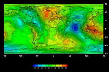
Credits: ESA - GOCE High Level Processing Facility
Cairo, Egypt. An historical city today looking for peace and prosperity on February 8, 2011
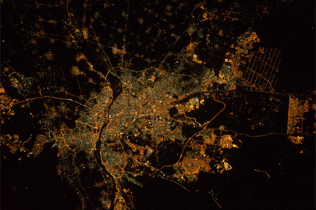
Bild: magisstra
ESA/NASA
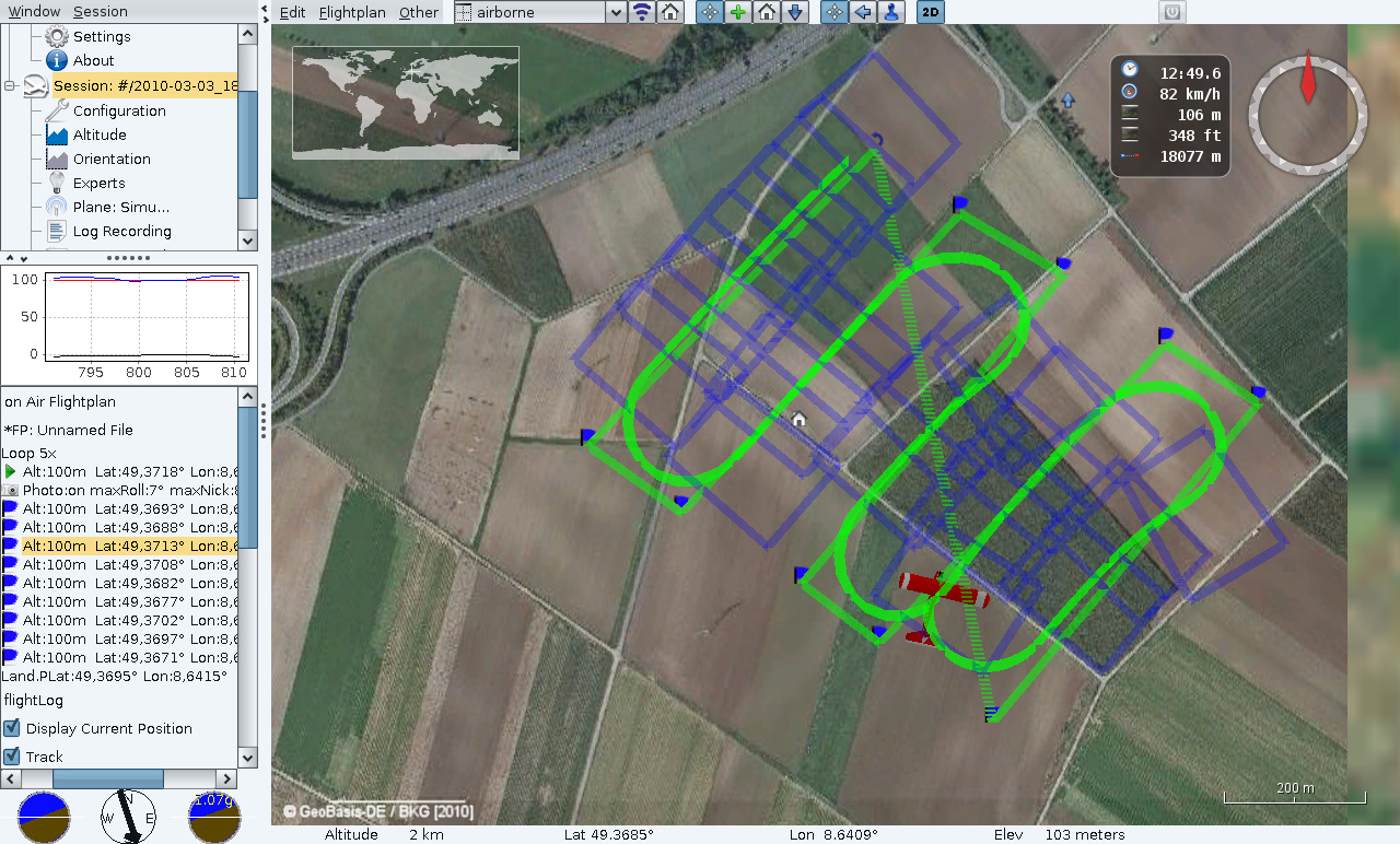
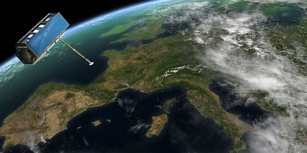
ESA – TTP2 – Satellite navigation steers unmanned micro-planes
-

- ESA – TTP2 – Satellite navigation steers unmanned micro-planes – images

-
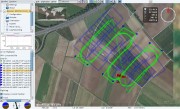
- Planning of a flight at Leimen near Heidelberg
-
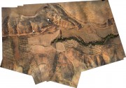
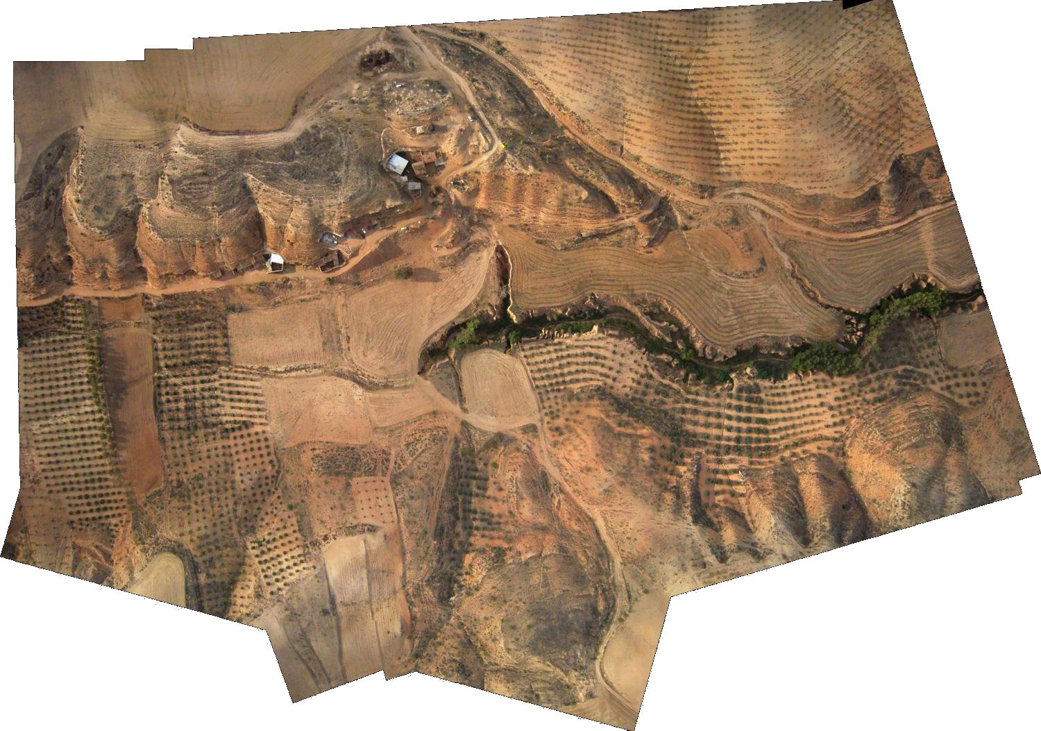
- Agricultural land areas and canyons near Baza in Andalusia
Hurricane Katrina: A NASA Satellite Video Retrospective [HD Video]
NASA Goddard Photo and Video – Flickr
-
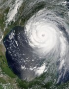
- Hurricane Katrina

-

- Hurricane Katrina

-
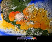
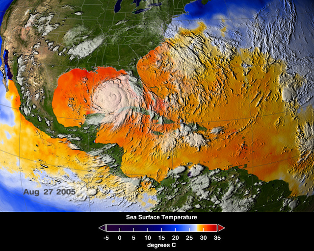
- Sea Surface Temperatures During Hurricane Katrina
Mount St. Helens: Thirty Years Later [HD Video] | Flickr – Fotosharing!
Las Vegas, Nevada – Urban Growth 1984-2009
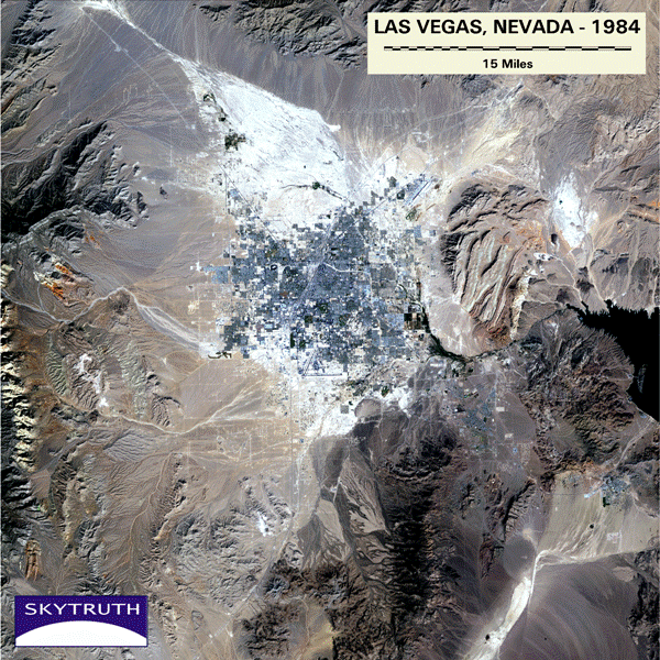
A time-series of Landsat-5 Thematic Mapper satellite images of Las Vegas, Nevada, taken from 1984 to 2009. This is an animated GIF file.
Bild: SkyTruth
Animierte Grafik zeigt die Entwicklung der Großstadt im Verlauf von 25 Jahren
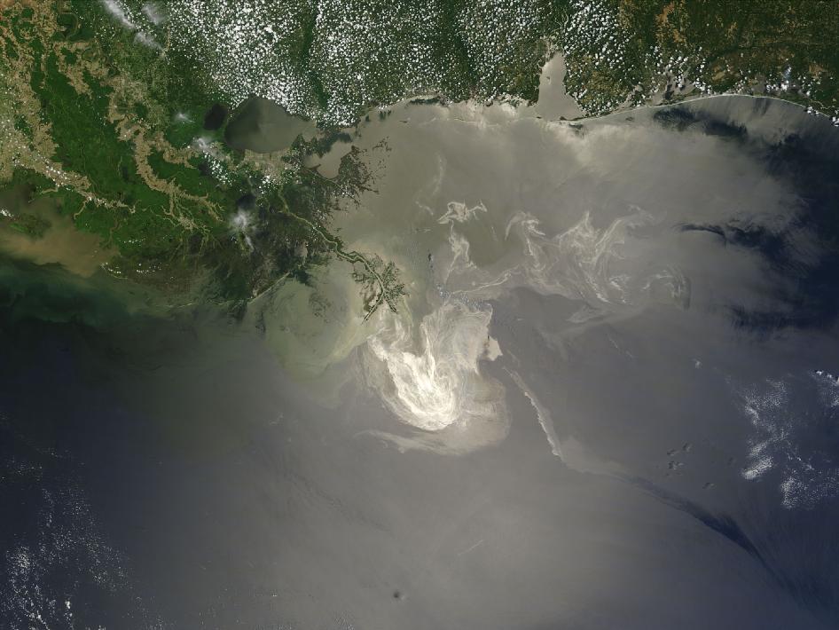
Deepwater Horizon Oil Spill – MODIS/Aqua Detail (with interpretation), July 28, 2010
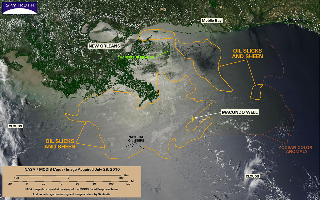
This MODIS / Aqua satellite image taken at 2 pm Central time on July 28, 2010, shows oil slicks and sheen (encircled with orange line), that are likely attributable to the BP / Deepwater Horizon oil spill, spread out across 11,832 square miles (30,644 km2) in the Gulf of Mexico. Given the steady dissipation in the oil slick that we've observed on satellite imagery over the past few days, and reports from the Coast Guard and independent observers, we are assuming that most of this is very thin sheen.
We've marked the eastern edge of a persistent ocean-color anomaly with a dashed line; this anomaly may simply be related to the Mississippi River discharge, or could indicate an area where ocean chemistry has been affected by oil, dispersant, and/or dissolved methane from the spill and cleanup response.
Three small slicks attributable to natural oil and gas seeps are also marked.
Bild: SkyTruth
NASA’s Terra Satellites Sees Spill on May 24
Sunlight illuminated the lingering oil slick off the Mississippi Delta on May 24, 2010. The Moderate Resolution Imaging Spectroradiometer (MODIS) on NASA’s Terra satellite captured this image the same day.
Oil smoothes the ocean surface, making the Sun’s reflection brighter near the centerline of the path of the satellite, and reducing the scattering of sunlight in other places. As a result, the oil slick is brighter than the surrounding water in some places (image center) and darker than the surrounding water in others (image lower right). The tip of the Mississippi Delta is surrounded by muddy water that appears light tan. Bright white ribbons of oil streak across this sediment-laden water.
Tendrils of oil extend to the north and east of the main body of the slick. A small, dark plume along the edge of the slick, not far from the original location of the Deepwater Horizon rig, indicates a possible controlled burn of oil on the ocean surface.
To the west of the bird’s-foot part of the delta, dark patches in the water may also be oil, but detecting a manmade oil slick in coastal areas can be even more complicated than detecting it in the open ocean.
When oil slicks are visible in satellite images, it is because they have changed how the water reflects light, either by making the Sun’s reflection brighter or by dampening the scattering of sunlight, which makes the oily area darker. In coastal areas, however, similar changes in reflectivity can occur from differences in salinity (fresh versus salt water) and from naturally produced oils from plants.
Michon Scott
NASA's Earth Observatory
NASA Goddard Space Flight Center
SkyTruth – Flickr
-
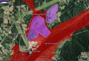
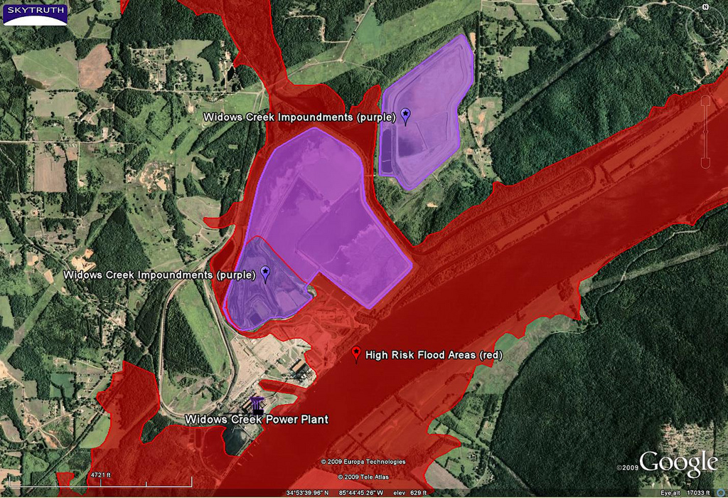
- Widows Creek Power Plant – Impoundments and High Risk Flood Zones | Flickr – Photo Sharing!
-

- Wind Farm – Texas | Flickr – Photo Sharing
-
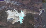
- Fort Knox Gold Mine, Alaska | Flickr – Photo Sharing!

-
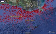
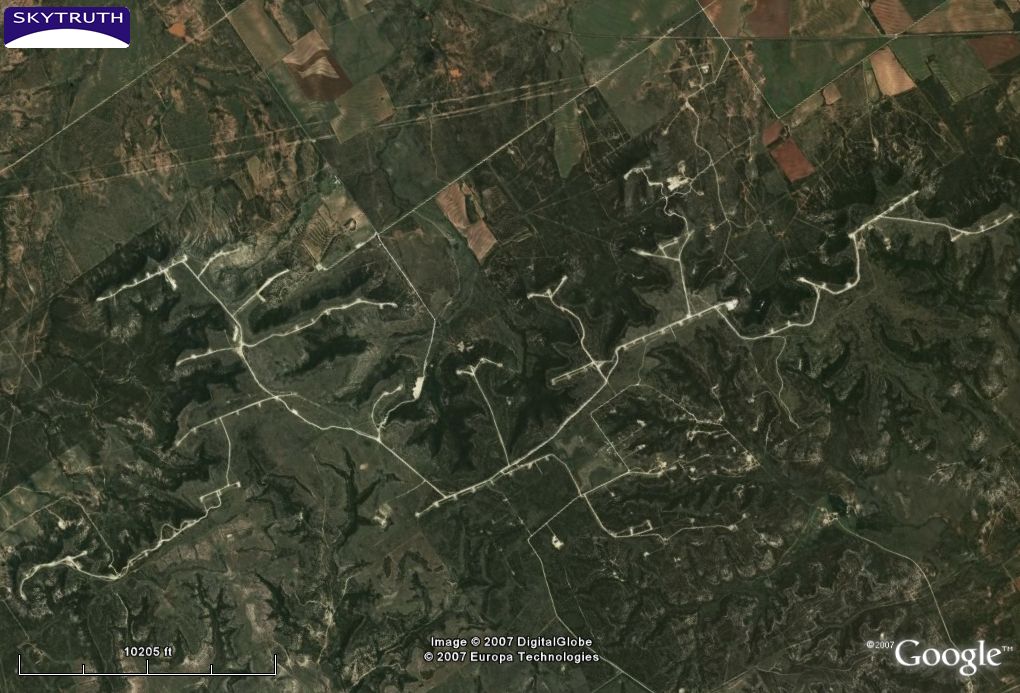
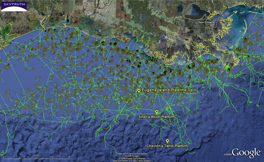
- Eugene Island Pipeline Spill – Location | Flickr – Photo Sharing!
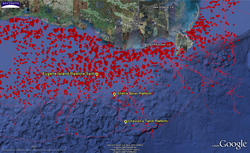
-
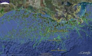
- SkyTruth: EugeneIsland pipelines | Flickr – Photo Sharing!
-
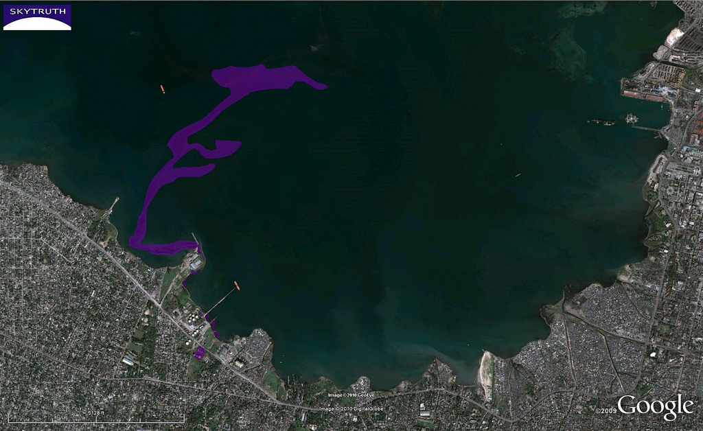
- Haiti Earthquake – Oil Spill, Overview | Flickr – Photo Sharing!
-
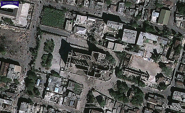
- Haiti Earthquake – Cathedral Area, After | Flickr – Photo Sharing!
-

- Haiti Earthquake – Cathedral Area, Before | Flickr – Photo Sharing!
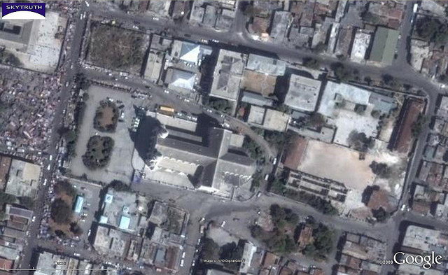
Bild: SkyTruth
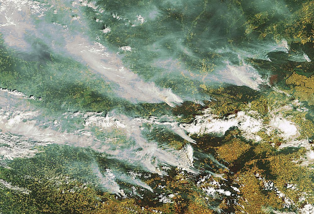
Earth from Space: Smoke over Moscow
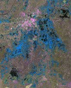
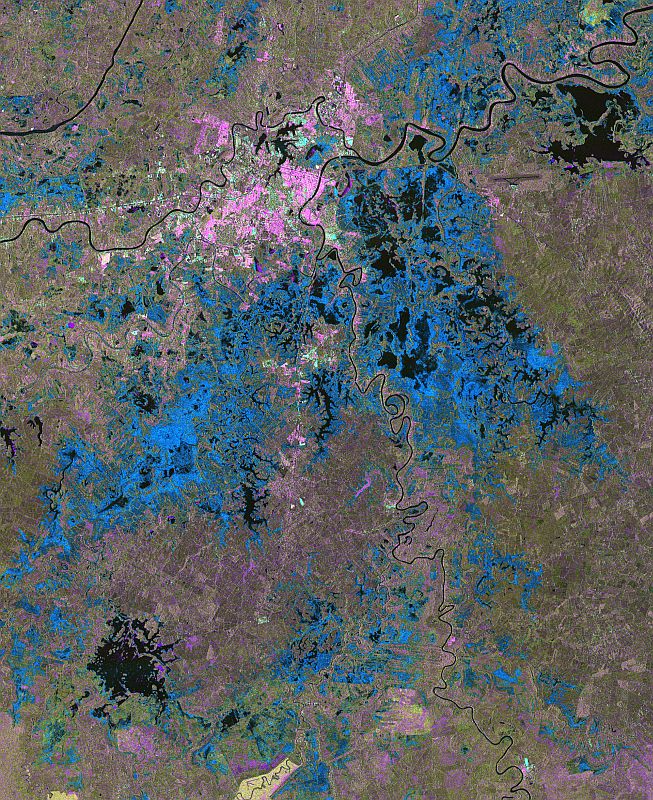
Satellitenkarte der überfluteten Fläche im Landkreis Märkisch-Oderland

Satellitenkarte der überfluteten Fläche im Landkreis Märkisch-Oderland, Deutschland, aus TerraSAR-X Daten vom 28. Mai 2010 - Übersicht 1:50.000
Bild: Karte DLR - ZKI
Satellitenkarte der überfluteten Fläche im Landkreis Märkisch-Oderland, Deutschland, aus TerraSAR-X Daten vom 28. Mai 2010 – Übersicht 1:50.000
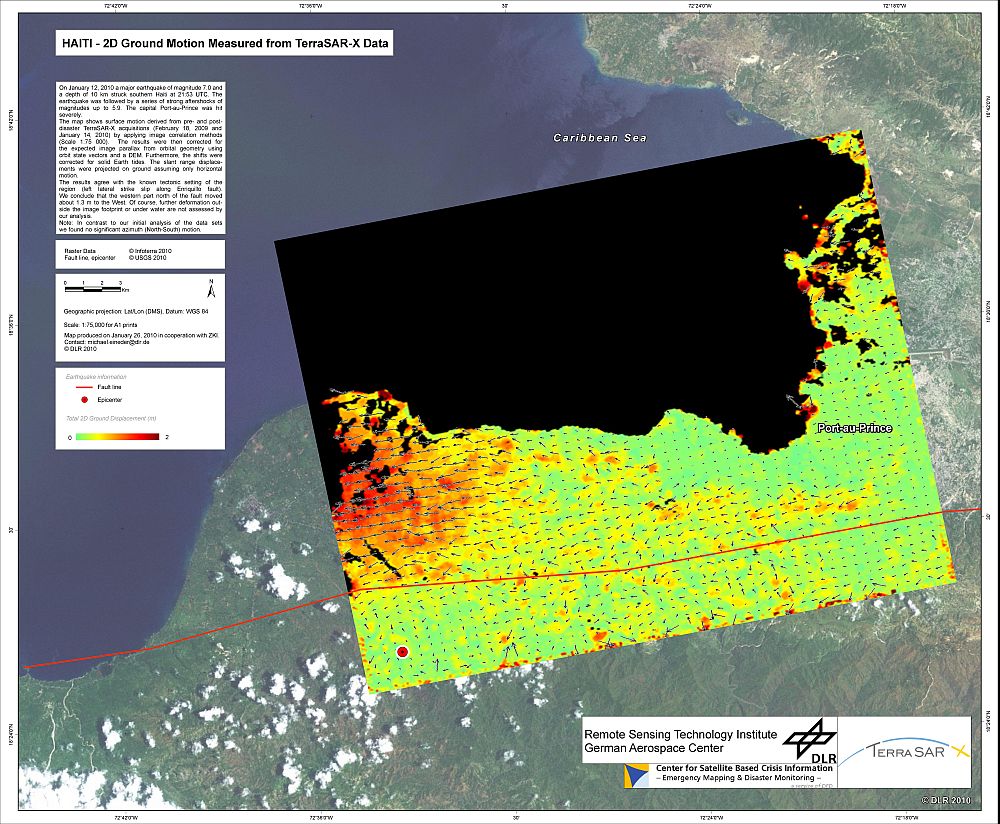
DLR Portal – TerraSAR-X-Bild des Monats: Erdkrustenbewegungen in Haiti beim Erdbeben vom 12. Januar 2010
-
- TerraSAR-X über Europa
-
- Radardaten unterstützen Krisenmanagement bei Überflutungen in Mexiko
-
- Bodenbewegungen in Haiti durch das Erdbeben vom 12. Januar 2010